很久没有写了,原因很简单没有想起来,够简单粗暴吧,好吧承认都是借口
—————————————————我是分界线哦————————————————————————
昨天GIS程序与开发课结束了它的完整生命周期,老师让我们每个人做个总结。学号最后一个,便最后一个总结。
课程上完,最大感受,嗯,我又学会了怎么拼代码!老师给我说了我的优缺点,可能当时没反应过来,今天早上才反应过来
,所以写下该文。工作做的很多,成果别人看不到,自己学到的帮助其他同学,自己却不能从他们那获得有用的知识,这也是要求我多总结
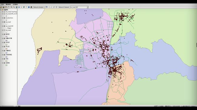
,并且是阶段性的总结。那就列一下自己课程代码吧,项目名称:《道路分析系统》,基于vs2010(C#开发)+ArcEngine10.2+ArcGIS10.2
虽然我是代码搬运工,但我不在乎啊。
-----------------------------------------------
主窗体代码


1 // This is the main form of the application. 2 3 namespace NAEngine 4 { 5 ///6 /// Summary description for Form1. 7 /// 8 public class frmMain : System.Windows.Forms.Form 9 { 10 /// 11 /// Required designer variable. 12 /// 13 private System.ComponentModel.Container components = null; 14 private System.Windows.Forms.Splitter splitter1; 15 16 // Context menu objects for NAWindow's context menu 17 private System.Windows.Forms.ContextMenu contextMenu1; 18 private System.Windows.Forms.MenuItem miLoadLocations; 19 private System.Windows.Forms.MenuItem miClearLocations; 20 private System.Windows.Forms.MenuItem miAddItem; 21 22 // ArcGIS Controls on the form 23 private ESRI.ArcGIS.Controls.AxMapControl axMapControl1; 24 private ESRI.ArcGIS.Controls.AxLicenseControl axLicenseControl1; 25 private ESRI.ArcGIS.Controls.AxToolbarControl axToolbarControl1; 26 private ESRI.ArcGIS.Controls.AxTOCControl axTOCControl1; 27 28 // Listen for context menu on NAWindow 29 private IEngineNAWindowEventsEx_OnContextMenuEventHandler m_onContextMenu; 30 31 // Reference to Network Analyst Environment 32 private IEngineNetworkAnalystEnvironment m_naEnv; 33 34 // Reference to NAWindow. Need to hold on to reference for events to work. 35 private IEngineNAWindow m_naWindow; 36 37 // Menu for our commands on the TOC context menu 38 private IToolbarMenu m_menuLayer; 39 private MenuStrip menuStrip1; 40 private ToolStripMenuItem 文件ToolStripMenuItem; 41 private ToolStripMenuItem ToolStripMenuItemQueryByAttribute; 42 private ToolStripMenuItem ToolStripMenuItemQueryBySpatial; 43 private ToolStripMenuItem ToolStripMenuItemOpen; 44 private StatusStrip statusStrip1; 45 private ToolStripStatusLabel toolStripStatusMessage; 46 private ToolStripStatusLabel toolStripStatusBlank; 47 private ToolStripStatusLabel toolStripStatusScale; 48 private ToolStripStatusLabel toolStripStatusCoordinates; 49 50 // incrementor for auto generated names 51 private static int autogenInt = 0; 52 53 public frmMain() 54 { 55 // 56 // Required for Windows Form Designer support 57 // 58 InitializeComponent(); 59 } 60 61 /// 62 /// Clean up any resources being used. 63 /// 64 protected override void Dispose(bool disposing) 65 { 66 ESRI.ArcGIS.ADF.COMSupport.AOUninitialize.Shutdown(); 67 68 if (disposing) 69 { 70 if (components != null) 71 { 72 components.Dispose(); 73 } 74 } 75 base.Dispose(disposing); 76 } 77 78 #region Windows Form Designer generated code 79 /// 80 /// Required method for Designer support - do not modify 81 /// the contents of this method with the code editor. 82 /// 83 private void InitializeComponent() 84 { 85 System.ComponentModel.ComponentResourceManager resources = new System.ComponentModel.ComponentResourceManager(typeof(frmMain)); 86 this.axMapControl1 = new ESRI.ArcGIS.Controls.AxMapControl(); 87 this.axLicenseControl1 = new ESRI.ArcGIS.Controls.AxLicenseControl(); 88 this.axToolbarControl1 = new ESRI.ArcGIS.Controls.AxToolbarControl(); 89 this.splitter1 = new System.Windows.Forms.Splitter(); 90 this.axTOCControl1 = new ESRI.ArcGIS.Controls.AxTOCControl(); 91 this.contextMenu1 = new System.Windows.Forms.ContextMenu(); 92 this.miLoadLocations = new System.Windows.Forms.MenuItem(); 93 this.miClearLocations = new System.Windows.Forms.MenuItem(); 94 this.miAddItem = new System.Windows.Forms.MenuItem(); 95 this.menuStrip1 = new System.Windows.Forms.MenuStrip(); 96 this.文件ToolStripMenuItem = new System.Windows.Forms.ToolStripMenuItem(); 97 this.ToolStripMenuItemOpen = new System.Windows.Forms.ToolStripMenuItem(); 98 this.ToolStripMenuItemQueryByAttribute = new System.Windows.Forms.ToolStripMenuItem(); 99 this.ToolStripMenuItemQueryBySpatial = new System.Windows.Forms.ToolStripMenuItem(); 100 this.statusStrip1 = new System.Windows.Forms.StatusStrip(); 101 this.toolStripStatusMessage = new System.Windows.Forms.ToolStripStatusLabel(); 102 this.toolStripStatusBlank = new System.Windows.Forms.ToolStripStatusLabel(); 103 this.toolStripStatusScale = new System.Windows.Forms.ToolStripStatusLabel(); 104 this.toolStripStatusCoordinates = new System.Windows.Forms.ToolStripStatusLabel(); 105 ((System.ComponentModel.ISupportInitialize)(this.axMapControl1)).BeginInit(); 106 ((System.ComponentModel.ISupportInitialize)(this.axLicenseControl1)).BeginInit(); 107 ((System.ComponentModel.ISupportInitialize)(this.axToolbarControl1)).BeginInit(); 108 ((System.ComponentModel.ISupportInitialize)(this.axTOCControl1)).BeginInit(); 109 this.menuStrip1.SuspendLayout(); 110 this.statusStrip1.SuspendLayout(); 111 this.SuspendLayout(); 112 // 113 // axMapControl1 114 // 115 this.axMapControl1.Dock = System.Windows.Forms.DockStyle.Fill; 116 this.axMapControl1.Location = new System.Drawing.Point(173, 53); 117 this.axMapControl1.Name = "axMapControl1"; 118 this.axMapControl1.OcxState = ((System.Windows.Forms.AxHost.State)(resources.GetObject("axMapControl1.OcxState"))); 119 this.axMapControl1.Size = new System.Drawing.Size(706, 454); 120 this.axMapControl1.TabIndex = 2; 121 this.axMapControl1.OnMouseMove += new ESRI.ArcGIS.Controls.IMapControlEvents2_Ax_OnMouseMoveEventHandler(this.axMapControl1_OnMouseMove); 122 // 123 // axLicenseControl1 124 // 125 this.axLicenseControl1.Enabled = true; 126 this.axLicenseControl1.Location = new System.Drawing.Point(797, 0); 127 this.axLicenseControl1.Name = "axLicenseControl1"; 128 this.axLicenseControl1.OcxState = ((System.Windows.Forms.AxHost.State)(resources.GetObject("axLicenseControl1.OcxState"))); 129 this.axLicenseControl1.Size = new System.Drawing.Size(32, 32); 130 this.axLicenseControl1.TabIndex = 1; 131 // 132 // axToolbarControl1 133 // 134 this.axToolbarControl1.Dock = System.Windows.Forms.DockStyle.Top; 135 this.axToolbarControl1.Location = new System.Drawing.Point(0, 25); 136 this.axToolbarControl1.Name = "axToolbarControl1"; 137 this.axToolbarControl1.OcxState = ((System.Windows.Forms.AxHost.State)(resources.GetObject("axToolbarControl1.OcxState"))); 138 this.axToolbarControl1.Size = new System.Drawing.Size(879, 28); 139 this.axToolbarControl1.TabIndex = 0; 140 // 141 // splitter1 142 // 143 this.splitter1.Location = new System.Drawing.Point(170, 53); 144 this.splitter1.Name = "splitter1"; 145 this.splitter1.Size = new System.Drawing.Size(3, 454); 146 this.splitter1.TabIndex = 4; 147 this.splitter1.TabStop = false; 148 // 149 // axTOCControl1 150 // 151 this.axTOCControl1.Dock = System.Windows.Forms.DockStyle.Left; 152 this.axTOCControl1.Location = new System.Drawing.Point(0, 53); 153 this.axTOCControl1.Name = "axTOCControl1"; 154 this.axTOCControl1.OcxState = ((System.Windows.Forms.AxHost.State)(resources.GetObject("axTOCControl1.OcxState"))); 155 this.axTOCControl1.Size = new System.Drawing.Size(170, 454); 156 this.axTOCControl1.TabIndex = 1; 157 this.axTOCControl1.OnMouseDown += new ESRI.ArcGIS.Controls.ITOCControlEvents_Ax_OnMouseDownEventHandler(this.axTOCControl1_OnMouseDown); 158 // 159 // contextMenu1 160 // 161 this.contextMenu1.MenuItems.AddRange(new System.Windows.Forms.MenuItem[] { 162 this.miLoadLocations, 163 this.miClearLocations}); 164 // 165 // miLoadLocations 166 // 167 this.miLoadLocations.Index = 0; 168 this.miLoadLocations.Text = "Load Locations..."; 169 this.miLoadLocations.Click += new System.EventHandler(this.miLoadLocations_Click); 170 // 171 // miClearLocations 172 // 173 this.miClearLocations.Index = 1; 174 this.miClearLocations.Text = "Clear Locations"; 175 this.miClearLocations.Click += new System.EventHandler(this.miClearLocations_Click); 176 // 177 // miAddItem 178 // 179 this.miAddItem.Index = -1; 180 this.miAddItem.Text = "Add Item"; 181 this.miAddItem.Click += new System.EventHandler(this.miAddItem_Click); 182 // 183 // menuStrip1 184 // 185 this.menuStrip1.Items.AddRange(new System.Windows.Forms.ToolStripItem[] { 186 this.文件ToolStripMenuItem, 187 this.ToolStripMenuItemQueryByAttribute, 188 this.ToolStripMenuItemQueryBySpatial}); 189 this.menuStrip1.Location = new System.Drawing.Point(0, 0); 190 this.menuStrip1.Name = "menuStrip1"; 191 this.menuStrip1.Size = new System.Drawing.Size(879, 25); 192 this.menuStrip1.TabIndex = 5; 193 this.menuStrip1.Text = "menuStrip1"; 194 // 195 // 文件ToolStripMenuItem 196 // 197 this.文件ToolStripMenuItem.DropDownItems.AddRange(new System.Windows.Forms.ToolStripItem[] { 198 this.ToolStripMenuItemOpen}); 199 this.文件ToolStripMenuItem.Name = "文件ToolStripMenuItem"; 200 this.文件ToolStripMenuItem.Size = new System.Drawing.Size(44, 21); 201 this.文件ToolStripMenuItem.Text = "文件"; 202 // 203 // ToolStripMenuItemOpen 204 // 205 this.ToolStripMenuItemOpen.Name = "ToolStripMenuItemOpen"; 206 this.ToolStripMenuItemOpen.Size = new System.Drawing.Size(100, 22); 207 this.ToolStripMenuItemOpen.Text = "打开"; 208 this.ToolStripMenuItemOpen.Click += new System.EventHandler(this.ToolStripMenuItemOpen_Click); 209 // 210 // ToolStripMenuItemQueryByAttribute 211 // 212 this.ToolStripMenuItemQueryByAttribute.Name = "ToolStripMenuItemQueryByAttribute"; 213 this.ToolStripMenuItemQueryByAttribute.Size = new System.Drawing.Size(68, 21); 214 this.ToolStripMenuItemQueryByAttribute.Text = "属性查询"; 215 this.ToolStripMenuItemQueryByAttribute.Click += new System.EventHandler(this.ToolStripMenuItemQueryByAttribute_Click); 216 // 217 // ToolStripMenuItemQueryBySpatial 218 // 219 this.ToolStripMenuItemQueryBySpatial.Name = "ToolStripMenuItemQueryBySpatial"; 220 this.ToolStripMenuItemQueryBySpatial.Size = new System.Drawing.Size(68, 21); 221 this.ToolStripMenuItemQueryBySpatial.Text = "空间查询"; 222 this.ToolStripMenuItemQueryBySpatial.Click += new System.EventHandler(this.ToolStripMenuItemQueryBySpatial_Click); 223 // 224 // statusStrip1 225 // 226 this.statusStrip1.Items.AddRange(new System.Windows.Forms.ToolStripItem[] { 227 this.toolStripStatusMessage, 228 this.toolStripStatusBlank, 229 this.toolStripStatusScale, 230 this.toolStripStatusCoordinates}); 231 this.statusStrip1.Location = new System.Drawing.Point(173, 485); 232 this.statusStrip1.Name = "statusStrip1"; 233 this.statusStrip1.Size = new System.Drawing.Size(706, 22); 234 this.statusStrip1.TabIndex = 10; 235 this.statusStrip1.Text = "statusStrip1"; 236 // 237 // toolStripStatusMessage 238 // 239 this.toolStripStatusMessage.Name = "toolStripStatusMessage"; 240 this.toolStripStatusMessage.Size = new System.Drawing.Size(32, 17); 241 this.toolStripStatusMessage.Text = "就绪"; 242 // 243 // toolStripStatusBlank 244 // 245 this.toolStripStatusBlank.Name = "toolStripStatusBlank"; 246 this.toolStripStatusBlank.Size = new System.Drawing.Size(535, 17); 247 this.toolStripStatusBlank.Spring = true; 248 // 249 // toolStripStatusScale 250 // 251 this.toolStripStatusScale.Name = "toolStripStatusScale"; 252 this.toolStripStatusScale.Size = new System.Drawing.Size(56, 17); 253 this.toolStripStatusScale.Text = "当前坐标"; 254 // 255 // toolStripStatusCoordinates 256 // 257 this.toolStripStatusCoordinates.Name = "toolStripStatusCoordinates"; 258 this.toolStripStatusCoordinates.Size = new System.Drawing.Size(68, 17); 259 this.toolStripStatusCoordinates.Text = "当前比例尺"; 260 this.toolStripStatusCoordinates.Click += new System.EventHandler(this.toolStripStatusCoordinates_Click); 261 // 262 // frmMain 263 // 264 this.AutoScaleBaseSize = new System.Drawing.Size(6, 14); 265 this.ClientSize = new System.Drawing.Size(879, 507); 266 this.Controls.Add(this.statusStrip1); 267 this.Controls.Add(this.axLicenseControl1); 268 this.Controls.Add(this.axMapControl1); 269 this.Controls.Add(this.splitter1); 270 this.Controls.Add(this.axTOCControl1); 271 this.Controls.Add(this.axToolbarControl1); 272 this.Controls.Add(this.menuStrip1); 273 this.Icon = ((System.Drawing.Icon)(resources.GetObject("$this.Icon"))); 274 this.MainMenuStrip = this.menuStrip1; 275 this.Name = "frmMain"; 276 this.Text = "Road analysis System"; 277 this.Load += new System.EventHandler(this.frmMain_Load); 278 ((System.ComponentModel.ISupportInitialize)(this.axMapControl1)).EndInit(); 279 ((System.ComponentModel.ISupportInitialize)(this.axLicenseControl1)).EndInit(); 280 ((System.ComponentModel.ISupportInitialize)(this.axToolbarControl1)).EndInit(); 281 ((System.ComponentModel.ISupportInitialize)(this.axTOCControl1)).EndInit(); 282 this.menuStrip1.ResumeLayout(false); 283 this.menuStrip1.PerformLayout(); 284 this.statusStrip1.ResumeLayout(false); 285 this.statusStrip1.PerformLayout(); 286 this.ResumeLayout(false); 287 this.PerformLayout(); 288 289 } 290 #endregion 291 292 /// 293 /// The main entry point for the application. 294 /// 295 [STAThread] 296 static void Main() 297 { 298 if (!ESRI.ArcGIS.RuntimeManager.Bind(ESRI.ArcGIS.ProductCode.Engine)) 299 { 300 if (!ESRI.ArcGIS.RuntimeManager.Bind(ESRI.ArcGIS.ProductCode.Desktop)) 301 { 302 if (ESRI.ArcGIS.RuntimeManager.ActiveRuntime.Version == "") // "" is less than 10 303 { 304 System.Windows.Forms.MessageBox.Show("Loading ArcGIS Version Failed"); 305 return; 306 } 307 } 308 } 309 310 Application.Run(new frmMain()); 311 } 312 313 private void frmMain_Load(object sender, System.EventArgs e) 314 { 315 // Add commands to the NALayer context menu 316 m_menuLayer = new ToolbarMenuClass(); 317 318 int nItem = -1; 319 m_menuLayer.AddItem(new cmdLoadLocations(), -1, ++nItem, false, esriCommandStyles.esriCommandStyleTextOnly); 320 m_menuLayer.AddItem(new cmdRemoveLayer(), -1, ++nItem, false, esriCommandStyles.esriCommandStyleTextOnly); 321 m_menuLayer.AddItem(new cmdClearAnalysisLayer(), -1, ++nItem, true, esriCommandStyles.esriCommandStyleTextOnly); 322 m_menuLayer.AddItem(new cmdNALayerProperties(), -1, ++nItem, true, esriCommandStyles.esriCommandStyleTextOnly); 323 m_menuLayer.SetHook(axMapControl1); 324 325 // Add command for Network Analyst env properties to end of "Network Analyst" dropdown menu 326 nItem = -1; 327 for (int i = 0; i < axToolbarControl1.Count; ++i) 328 { 329 IToolbarItem item = axToolbarControl1.GetItem(i); 330 IToolbarMenu mnu = item.Menu; 331 332 if (mnu == null) 333 continue; 334 335 IMenuDef mnudef = mnu.GetMenuDef(); 336 string name = mnudef.Name; 337 if (name == "ControlToolsNetworkAnalyst_SolverMenu") 338 { 339 nItem = i; 340 break; 341 } 342 } 343 344 if (nItem >= 0) 345 { 346 IToolbarItem item = axToolbarControl1.GetItem(nItem); 347 IToolbarMenu mnu = item.Menu; 348 if (mnu != null) 349 mnu.AddItem(new cmdNAProperties(), -1, mnu.Count, true, esriCommandStyles.esriCommandStyleTextOnly); 350 } 351 352 // Initialize naEnv variables 353 m_naEnv = new EngineNetworkAnalystEnvironmentClass(); 354 m_naEnv.ZoomToResultAfterSolve = false; 355 m_naEnv.ShowAnalysisMessagesAfterSolve = (int)(esriEngineNAMessageType.esriEngineNAMessageTypeInformative | esriEngineNAMessageType.esriEngineNAMessageTypeWarning); 356 357 // Explicitly setup buddy control and initialize NA extension 358 // so we can get to NAWindow to listen to window events 359 // This is necessary the various controls are not yet setup and they 360 // need to be in order to get the NAWindow's events. 361 axToolbarControl1.SetBuddyControl(axMapControl1); 362 IExtension ext = m_naEnv as IExtension; 363 object obj = axToolbarControl1.Object; 364 ext.Startup(ref obj); 365 m_naWindow = m_naEnv.NAWindow; 366 m_onContextMenu = new IEngineNAWindowEventsEx_OnContextMenuEventHandler(OnContextMenu); 367 ((IEngineNAWindowEventsEx_Event)m_naWindow).OnContextMenu += m_onContextMenu; 368 } 369 370 // Show the TOC context menu when an NALayer is right-clicked on 371 private void axTOCControl1_OnMouseDown(object sender, ESRI.ArcGIS.Controls.ITOCControlEvents_OnMouseDownEvent e) 372 { 373 if (e.button != 2) return; 374 375 esriTOCControlItem item = esriTOCControlItem.esriTOCControlItemNone; 376 IBasicMap map = null; 377 ILayer layer = null; 378 object other = null; 379 object index = null; 380 381 //Determine what kind of item has been clicked on 382 axTOCControl1.HitTest(e.x, e.y, ref item, ref map, ref layer, ref other, ref index); 383 384 // Only implemented a context menu for NALayers. Exit if the layer is anything else. 385 if ((layer as INALayer) == null) 386 return; 387 388 axTOCControl1.SelectItem(layer); 389 390 // Set the layer into the CustomProperty. 391 // This is used by the other commands to know what layer was right-clicked on 392 // in the table of contents. 393 axMapControl1.CustomProperty = layer; 394 395 //Popup the correct context menu and update the TOC when it's done. 396 if (item == esriTOCControlItem.esriTOCControlItemLayer) 397 { 398 m_menuLayer.PopupMenu(e.x, e.y, axTOCControl1.hWnd); 399 ITOCControl toc = axTOCControl1.Object as ITOCControl; 400 toc.Update(); 401 } 402 } 403 404 public bool OnContextMenu(int x, int y) 405 { 406 System.Drawing.Point pt = this.PointToClient(System.Windows.Forms.Cursor.Position); 407 408 //Get the active category 409 IEngineNAWindowCategory2 activeCategory = m_naWindow.ActiveCategory as IEngineNAWindowCategory2; 410 if (activeCategory == null) 411 return false; 412 413 MenuItem separator = new MenuItem("-"); 414 415 miLoadLocations.Enabled = false; 416 miClearLocations.Enabled = false; 417 418 // in order for the AddItem choice to appear in the context menu, the class 419 // should be an input class, and it should not be editable 420 INAClassDefinition pNAClassDefinition = activeCategory.NAClass.ClassDefinition; 421 if (pNAClassDefinition.IsInput) 422 { 423 424 miLoadLocations.Enabled = true; 425 miClearLocations.Enabled = true; 426 427 // canEditShape should be false for AddItem to Apply (default is false) 428 // if it's a StandaloneTable canEditShape is implicitly false (there's no shape to edit) 429 bool canEditShape = false; 430 IFields pFields = pNAClassDefinition.Fields; 431 int nField = -1; 432 nField = pFields.FindField("Shape"); 433 if (nField >= 0) 434 { 435 int naFieldType = 0; 436 naFieldType = pNAClassDefinition.get_FieldType("Shape"); 437 438 // determining whether or not the shape field can be edited consists of running a bitwise comparison 439 // on the FieldType of the shape field. See the online help for a list of the possible field types. 440 // For our case, we want to verify that the shape field is an input field. If it is an input field, 441 // then we do NOT want to display the Add Item menu option. 442 canEditShape = ((naFieldType & (int)esriNAFieldType.esriNAFieldTypeInput) == (int)esriNAFieldType.esriNAFieldTypeInput) ? true : false; 443 } 444 445 if (!canEditShape) 446 { 447 contextMenu1.MenuItems.Add(separator); 448 contextMenu1.MenuItems.Add(miAddItem); 449 } 450 } 451 452 contextMenu1.Show(this, pt); 453 454 // even if the miAddItem menu item has not been added, Remove() won't crash. 455 contextMenu1.MenuItems.Remove(separator); 456 contextMenu1.MenuItems.Remove(miAddItem); 457 458 return true; 459 } 460 461 private void miLoadLocations_Click(object sender, System.EventArgs e) 462 { 463 IMapControl3 mapControl = (IMapControl3)axMapControl1.Object; 464 465 // Show the Property Page form for Network Analyst 466 frmLoadLocations loadLocations = new frmLoadLocations(); 467 if (loadLocations.ShowModal(mapControl, m_naEnv)) 468 { 469 // notify that the context has changed because we have added locations to a NAClass within it 470 INAContextEdit contextEdit = m_naEnv.NAWindow.ActiveAnalysis.Context as INAContextEdit; 471 contextEdit.ContextChanged(); 472 473 // If loaded locations, refresh the NAWindow and the Screen 474 INALayer naLayer = m_naWindow.ActiveAnalysis; 475 mapControl.Refresh(esriViewDrawPhase.esriViewGeography, naLayer, mapControl.Extent); 476 m_naWindow.UpdateContent(m_naWindow.ActiveCategory); 477 } 478 } 479 480 private void miClearLocations_Click(object sender, System.EventArgs e) 481 { 482 IMapControl3 mapControl = (IMapControl3)axMapControl1.Object; 483 484 IEngineNetworkAnalystHelper naHelper = m_naEnv as IEngineNetworkAnalystHelper; 485 IEngineNAWindow naWindow = m_naWindow; 486 INALayer naLayer = naWindow.ActiveAnalysis; 487 488 // we do not have to run ContextChanged() as with adding an item and loading locations, 489 // because that is done by the DeleteAllNetworkLocations method. 490 naHelper.DeleteAllNetworkLocations(); 491 492 mapControl.Refresh(esriViewDrawPhase.esriViewGeography, naLayer, mapControl.Extent); 493 } 494 495 private void miAddItem_Click(object sender, System.EventArgs e) 496 { 497 // Developers Note: 498 // Once an item has been added, the user can double click on the item to edit the properties 499 // of the item. For the purposes of this sample, only the default values from the InitDefaultValues method 500 // and an auto generated Name value are populated initially for the new item. 501 502 IMapControl3 mapControl = (IMapControl3)axMapControl1.Object; 503 504 IEngineNAWindowCategory2 activeCategory = m_naWindow.ActiveCategory as IEngineNAWindowCategory2; 505 IDataLayer pDataLayer = activeCategory.DataLayer; 506 507 // In order to add an item, we need to create a new row in the class and populate it 508 // with the initial default values for that class. 509 ITable table = pDataLayer as ITable; 510 IRow row = table.CreateRow(); 511 IRowSubtypes rowSubtypes = row as IRowSubtypes; 512 rowSubtypes.InitDefaultValues(); 513 514 // we need to auto generate a display name for the newly added item. 515 // In some cases (depending on how the schema is set up) InitDefaultValues may result in a nonempty name string 516 // in these cases do not override the preexisting non-empty name string with our auto generated one. 517 IFeatureLayer ipFeatureLayer = activeCategory.Layer as IFeatureLayer; 518 IStandaloneTable ipStandaloneTable = pDataLayer as IStandaloneTable; 519 string name = ""; 520 if (ipFeatureLayer != null) 521 name = ipFeatureLayer.DisplayField; 522 else if (ipStandaloneTable != null) 523 name = ipStandaloneTable.DisplayField; 524 525 //If the display field is an empty string or does not represent an actual field on the NAClass just skip the auto generation. 526 // (Some custom solvers may not have set the DisplayField for example). 527 // Note: The name we are auto generating does not have any spaces in it. This is to ensure that any classes 528 // that are space sensitive will be able to handle the name (ex Specialties). 529 string currentName = ""; 530 int fieldIndex = row.Fields.FindField(name); 531 if (fieldIndex >= 0) 532 { 533 currentName = row.get_Value(fieldIndex) as string; 534 if (currentName.Length <= 0) 535 row.set_Value(fieldIndex, "Item" + ++autogenInt); 536 } 537 538 // A special case is OrderPairs NAClass because that effectively has a combined 2 field display field. 539 // You will have to hard code to look for that NAClassName and create a default name for 540 // both first order and second order field names so the name will display correctly 541 // (look for the NAClass Name and NOT the layer name). 542 INAClassDefinition naClassDef = activeCategory.NAClass.ClassDefinition; 543 if (naClassDef.Name == "OrderPairs") 544 { 545 fieldIndex = row.Fields.FindField("SecondOrderName"); 546 if (fieldIndex >= 0) 547 { 548 string secondName = row.get_Value(fieldIndex) as string; 549 if (secondName.Length <= 0) 550 row.set_Value(fieldIndex, "Item" + ++autogenInt); 551 } 552 } 553 554 row.Store(); 555 556 // notify that the context has changed because we have added an item to a NAClass within it 557 INAContextEdit contextEdit = m_naEnv.NAWindow.ActiveAnalysis.Context as INAContextEdit; 558 contextEdit.ContextChanged(); 559 560 // refresh the NAWindow and the Screen 561 INALayer naLayer = m_naWindow.ActiveAnalysis; 562 mapControl.Refresh(esriViewDrawPhase.esriViewGeography, naLayer, mapControl.Extent); 563 m_naWindow.UpdateContent(m_naWindow.ActiveCategory); 564 } 565 566 567 //打开文档 568 private void ToolStripMenuItemOpen_Click(object sender, EventArgs e) 569 { 570 //使用对话框选择要打开的mxd文档 571 using (OpenFileDialog openFileDialog = new OpenFileDialog()) 572 { 573 openFileDialog.Filter = "ArcMap Documents (*.mxd)|*.mxd"; 574 if (openFileDialog.ShowDialog() == System.Windows.Forms.DialogResult.OK) 575 { 576 string filePath = openFileDialog.FileName; 577 axMapControl1.LoadMxFile(filePath); 578 } 579 } 580 } 581 582 //属性查询&空间查询 583 584 private void ToolStripMenuItemQueryBySpatial_Click(object sender, EventArgs e) 585 { 586 //新创建空间查询窗体 587 FormQueryBySpatial formQueryBySpatial = new FormQueryBySpatial(); 588 //将当前主窗体中MapControl控件中的Map对象赋值给FormSelection窗体的CurrentMap属性 589 formQueryBySpatial.CurrentMap = axMapControl1.Map; 590 //显示空间查询窗体 591 formQueryBySpatial.Show(); 592 } 593 594 private void ToolStripMenuItemQueryByAttribute_Click(object sender, EventArgs e) 595 { 596 //新创建属性查询窗体 597 FormQueryByAttribute formQueryByAttribute = new FormQueryByAttribute(); 598 //将当前主窗体中MapControl控件中的Map对象赋值给FormQueryByAttribute窗体的CurrentMap属性 599 formQueryByAttribute.CurrentMap = axMapControl1.Map; 600 //显示属性查询窗体 601 formQueryByAttribute.Show(); 602 } 603 604 //脚标 坐标系等信息 605 606 private void toolStripStatusCoordinates_Click(object sender, EventArgs e) 607 { 608 609 } 610 611 private void axMapControl1_OnMouseMove(object sender, IMapControlEvents2_OnMouseMoveEvent e) 612 { 613 // 显示当前比例尺,整数 614 toolStripStatusScale.Text = " 比例尺 1:" + axMapControl1.MapScale.ToString("f0"); 615 616 // 显示当前坐标,保留小数点后四位 617 toolStripStatusCoordinates.Text = String.Format(" 当前坐标 X = {0}, Y={1} {2}", 618 e.mapX.ToString("f4"), 619 e.mapY.ToString("f4"), 620 YCMap.Utils.SystemHelper.ConvertEsriUnit(axMapControl1.MapUnits)); 621 } 622 623 private void axToolbarControl_OnMouseMove(object sender, IToolbarControlEvents_OnMouseMoveEvent e) 624 { 625 // 取得鼠标所在工具的索引号 626 int index = axToolbarControl1.HitTest(e.x, e.y, false); 627 if (index != -1) 628 { 629 // 取得鼠标所在工具的 ToolbarItem 630 IToolbarItem toolbarItem = axToolbarControl1.GetItem(index); 631 // 设置状态栏信息 632 toolStripStatusMessage.Text = toolbarItem.Command.Message; 633 } 634 else 635 { 636 toolStripStatusMessage.Text = " 就绪 "; 637 } 638 } 639 } 640 }
空间查询
1 namespace NAEngine 2 { 3 public partial class FormQueryBySpatial : Form 4 { 5 private IMap currentMap; //当前MapControl控件中的Map对象 6 7 ///8 /// 获得当前MapControl控件中的Map对象。 9 /// 10 public IMap CurrentMap 11 { 12 set 13 { 14 currentMap = value; 15 } 16 } 17 18 public FormQueryBySpatial() 19 { 20 InitializeComponent(); 21 } 22 23 //窗体加载时触发事件,执行本函数 24 private void FormQueryBySpatial_Load(object sender, EventArgs e) 25 { 26 try 27 { 28 //清空目标图层列表 29 checkedListBoxTargetLayers.Items.Clear(); 30 31 string layerName; //设置临时变量存储图层名称 32 33 //对Map中的每个图层进行判断并添加图层名称 34 for (int i = 0; i < currentMap.LayerCount; i++) 35 { 36 //如果该图层为图层组类型,则分别对所包含的每个图层进行操作 37 if (currentMap.get_Layer(i) is GroupLayer) 38 { 39 //使用ICompositeLayer接口进行遍历操作 40 ICompositeLayer compositeLayer = currentMap.get_Layer(i) as ICompositeLayer; 41 for (int j = 0; j < compositeLayer.Count; j++) 42 { 43 //将图层的名称添加到checkedListBoxTargetLayers控件和comboBoxMethods控件中 44 layerName = compositeLayer.get_Layer(j).Name; 45 checkedListBoxTargetLayers.Items.Add(layerName); 46 comboBoxSourceLayer.Items.Add(layerName); 47 } 48 } 49 //如果图层不是图层组类型,则直接添加名称 50 else 51 { 52 layerName = currentMap.get_Layer(i).Name; 53 checkedListBoxTargetLayers.Items.Add(layerName); 54 comboBoxSourceLayer.Items.Add(layerName); 55 } 56 } 57 58 //将comboBoxSourceLayer控件的默认选项设置为第一个图层的名称 59 comboBoxSourceLayer.SelectedIndex = 0; 60 //将comboBoxMethods控件的默认选项设置为第一种空间选择方法 61 comboBoxMethods.SelectedIndex = 0; 62 } 63 catch { } 64 } 65 66 private void buttonClose_Click(object sender, EventArgs e) 67 { 68 this.Close(); 69 } 70 71 private void buttonApply_Click(object sender, EventArgs e) 72 { 73 try 74 { 75 SelectFeaturesBySpatial(); 76 } 77 catch 78 { } 79 } 80 81 private void buttonOK_Click(object sender, EventArgs e) 82 { 83 try 84 { 85 SelectFeaturesBySpatial(); 86 this.Close(); 87 } 88 catch 89 { } 90 } 91 92 /// 93 /// 在地图中根据图层名称获得矢量图层。 94 /// 95 /// 当前地图 96 /// 图层名称 97 /// IFeatureLayer接口的矢量图层对象 98 private IFeatureLayer GetFeatureLayerByName(IMap map, string layerName) 99 { 100 //对地图中的图层进行遍历 101 for (int i = 0; i < map.LayerCount; i++) 102 { 103 //如果该图层为图层组类型,则分别对所包含的每个图层进行操作 104 if (map.get_Layer(i) is GroupLayer) 105 { 106 //使用ICompositeLayer接口进行遍历操作 107 ICompositeLayer compositeLayer = map.get_Layer(i) as ICompositeLayer; 108 for (int j = 0; j < compositeLayer.Count; j++) 109 { 110 //如果图层名称为所要查询的图层名称,则返回IFeatureLayer接口的矢量图层对象 111 if (compositeLayer.get_Layer(j).Name == layerName) 112 return (IFeatureLayer)compositeLayer.get_Layer(j); 113 } 114 } 115 //如果图层不是图层组类型,则直接进行判断 116 else 117 { 118 if (map.get_Layer(i).Name == layerName) 119 return (IFeatureLayer)map.get_Layer(i); 120 } 121 } 122 return null; 123 } 124 125 /// 126 /// 将矢量图层中所有要素的几何体进行Union操作得到一个合并后的新几何体。 127 /// 128 /// 进行操作的矢量图层 129 /// 合并后的新几何体 130 private IGeometry GetFeatureLayerGeometryUnion(IFeatureLayer featureLayer) 131 { 132 //定义IGeometry接口的对象,存储每一步拓扑操作后得到的几何体 133 IGeometry geometry = null; 134 //使用ITopologicalOperator接口进行几何体的拓扑操作 135 ITopologicalOperator topologicalOperator; 136 //使用null作为查询过滤器得到图层中所有要素的游标 137 IFeatureCursor featureCursor = featureLayer.Search(null, false); 138 //获取IFeature接口的游标中的第一个元素 139 IFeature feature = featureCursor.NextFeature(); 140 //当游标不为空时 141 while (feature != null) 142 { 143 //如果几何体不为空 144 if (geometry != null) 145 { 146 //进行接口转换,使用当前几何体的ITopologicalOperator接口进行拓扑操作 147 topologicalOperator = geometry as ITopologicalOperator; 148 //执行拓扑合并操作,将当前要素的几何体与已有几何体进行Union,返回新的合并后的几何体 149 geometry = topologicalOperator.Union(feature.Shape); 150 } 151 else 152 geometry = feature.Shape; 153 //移动游标到下一个要素 154 feature = featureCursor.NextFeature(); 155 } 156 //返回最新合并后的几何体 157 return geometry; 158 } 159 160 /// 161 /// 根据已配置的查询条件来执行空间查询操作。 162 /// 163 private void SelectFeaturesBySpatial() 164 { 165 //定义和创建用于空间查询的ISpatialFilter接口的对象 166 ISpatialFilter spatialFilter = new SpatialFilterClass(); 167 //默认设定用于查询的空间几何体为当前地图源图层中所有要素几何体的集合 168 spatialFilter.Geometry = GetFeatureLayerGeometryUnion 169 (GetFeatureLayerByName(currentMap, comboBoxSourceLayer.SelectedItem.ToString())); 170 //根据对空间选择方法的选择采用相应的空间选择方法 171 switch (comboBoxMethods.SelectedIndex) 172 { 173 case 0: 174 spatialFilter.SpatialRel = esriSpatialRelEnum.esriSpatialRelIntersects; 175 break; 176 case 1: 177 spatialFilter.SpatialRel = esriSpatialRelEnum.esriSpatialRelWithin; 178 break; 179 case 2: 180 spatialFilter.SpatialRel = esriSpatialRelEnum.esriSpatialRelContains; 181 break; 182 case 3: 183 spatialFilter.SpatialRel = esriSpatialRelEnum.esriSpatialRelWithin; 184 break; 185 case 4: 186 spatialFilter.SpatialRel = esriSpatialRelEnum.esriSpatialRelTouches; 187 break; 188 case 5: 189 spatialFilter.SpatialRel = esriSpatialRelEnum.esriSpatialRelCrosses; 190 break; 191 default: 192 spatialFilter.SpatialRel = esriSpatialRelEnum.esriSpatialRelIntersects; 193 break; 194 } 195 196 //对所选择的目标图层进行遍历,并对每一个图层进行空间查询操作,查询结果将放在选择集中 197 IFeatureLayer featureLayer; 198 //对所有被选择的目标图层进行遍历 199 for (int i = 0; i < checkedListBoxTargetLayers.CheckedItems.Count; i++) 200 { 201 //根据选择的目标图层名称获得对应的矢量图层 202 featureLayer = GetFeatureLayerByName(currentMap, (string)checkedListBoxTargetLayers.CheckedItems[i]); 203 //进行接口转换,使用IFeatureSelection接口选择要素 204 IFeatureSelection featureSelection = featureLayer as IFeatureSelection; 205 //使用IFeatureSelection接口的SelectFeatures方法根据空间查询过滤器选择要素,将其放在新的选择集中 206 featureSelection.SelectFeatures((IQueryFilter)spatialFilter, esriSelectionResultEnum.esriSelectionResultAdd, false); 207 } 208 209 //进行接口转换,使用IActiveView接口进行视图操作 210 IActiveView activeView = currentMap as IActiveView; 211 //部分刷新操作,只刷新地理选择集的内容 212 activeView.PartialRefresh(esriViewDrawPhase.esriViewGeoSelection, null, activeView.Extent); 213 } 214 } 215 }
属性查询
1 namespace NAEngine 2 { 3 public partial class FormQueryByAttribute : Form 4 { 5 private IMap currentMap; //当前MapControl控件中的Map对象 6 private IFeatureLayer currentFeatureLayer; //设置临时类变量来使用IFeatureLayer接口的当前图层对象 7 private string currentFieldName; //设置临时类变量来存储字段名称 8 9 ///10 /// 获得当前MapControl控件中的Map对象。 11 /// 12 public IMap CurrentMap 13 { 14 set 15 { 16 currentMap = value; 17 } 18 } 19 20 public FormQueryByAttribute() 21 { 22 InitializeComponent(); 23 } 24 25 //窗体加载时触发事件,执行本函数 26 private void FormQueryByAttribute_Load(object sender, EventArgs e) 27 { 28 try 29 { 30 //将当前图层列表清空 31 comboBoxLayerName.Items.Clear(); 32 33 string layerName; //设置临时变量存储图层名称 34 35 //对Map中的每个图层进行判断并加载名称 36 for (int i = 0; i < currentMap.LayerCount; i++) 37 { 38 //如果该图层为图层组类型,则分别对所包含的每个图层进行操作 39 if (currentMap.get_Layer(i) is GroupLayer) 40 { 41 //使用ICompositeLayer接口进行遍历操作 42 ICompositeLayer compositeLayer = currentMap.get_Layer(i) as ICompositeLayer; 43 for (int j = 0; j < compositeLayer.Count; j++) 44 { 45 //将图层的名称添加到comboBoxLayerName控件中 46 layerName = compositeLayer.get_Layer(j).Name; 47 comboBoxLayerName.Items.Add(layerName); 48 } 49 } 50 //如果图层不是图层组类型,则直接添加名称 51 else 52 { 53 layerName = currentMap.get_Layer(i).Name; 54 comboBoxLayerName.Items.Add(layerName); 55 } 56 } 57 58 //将comboBoxLayerName控件的默认选项设置为第一个图层的名称 59 comboBoxLayerName.SelectedIndex = 0; 60 //将comboBoxSelectMethod控件的默认选项设置为第一种选择方式 61 comboBoxSelectMethod.SelectedIndex = 0; 62 } 63 catch { } 64 } 65 66 //在图层名称下拉框控件中所选择图层发生改变时触发事件,执行本函数 67 private void comboBoxLayerName_SelectedIndexChanged(object sender, EventArgs e) 68 { 69 //首先将字段列表和字段值列表清空 70 listBoxFields.Items.Clear(); 71 listBoxValues.Items.Clear(); 72 73 IField field; //设置临时变量存储使用IField接口的对象 74 75 for (int i = 0; i < currentMap.LayerCount; i++) 76 { 77 if (currentMap.get_Layer(i) is GroupLayer) 78 { 79 ICompositeLayer compositeLayer = currentMap.get_Layer(i) as ICompositeLayer; 80 for (int j = 0; j < compositeLayer.Count; j++) 81 { 82 //判断图层的名称是否与comboBoxLayerName控件中选择的图层名称相同 83 if (compositeLayer.get_Layer(j).Name == comboBoxLayerName.SelectedItem.ToString()) 84 { 85 //如果相同则设置为整个窗体所使用的IFeatureLayer接口对象 86 currentFeatureLayer = compositeLayer.get_Layer(j) as IFeatureLayer; 87 break; 88 } 89 } 90 } 91 else 92 { 93 //判断图层的名称是否与comboBoxLayerName中选择的图层名称相同 94 if (currentMap.get_Layer(i).Name == comboBoxLayerName.SelectedItem.ToString()) 95 { 96 //如果相同则设置为整个窗体所使用的IFeatureLayer接口对象 97 currentFeatureLayer = currentMap.get_Layer(i) as IFeatureLayer; 98 break; 99 } 100 } 101 } 102 103 //使用IFeatureClass接口对该图层的所有属性字段进行遍历,并填充listBoxFields控件 104 for (int i = 0; i < currentFeatureLayer.FeatureClass.Fields.FieldCount; i++) 105 { 106 //根据索引值获取图层的字段 107 field = currentFeatureLayer.FeatureClass.Fields.get_Field(i); 108 //排除SHAPE字段,并在其它字段名称前后添加字符"和字符" 109 if (field.Name.ToUpper() != "SHAPE") 110 listBoxFields.Items.Add("\"" + field.Name + "\""); 111 } 112 113 //更新labelwhere控件中的图层名称信息 114 labelwhere.Text = currentFeatureLayer.Name + " WHERE:"; 115 116 //将显示where语句的文本框内容清空 117 textBoxWhere.Clear(); 118 } 119 120 //在字段名称列表控件中所选择的字段发生改变时触发事件,执行本函数 121 private void listBoxFields_SelectedIndexChanged(object sender, EventArgs e) 122 { 123 //首先将listBoxValues控件中的字段属性值清空 124 listBoxValues.Items.Clear(); 125 //将buttonGetUniqeValue按钮控件置为可用状态 126 if (buttonGetUniqeValue.Enabled == false) 127 buttonGetUniqeValue.Enabled = true; 128 129 //设置整个窗体可用的字段名称 130 string str = listBoxFields.SelectedItem.ToString(); 131 //使用string类中的方法将字段名称中的两个"字符去掉 132 str = str.Substring(1); 133 str = str.Substring(0, str.Length - 1); 134 currentFieldName = str; 135 } 136 137 //在点击“获取唯一属性值”按钮时触发事件,执行本函数 138 //对图层的某个字段进行唯一值获取操作,并将所有的唯一值显示在listBoxValues控件中 139 private void buttonGetUniqeValue_Click(object sender, EventArgs e) 140 { 141 try 142 { 143 //使用FeatureClass对象的IDataset接口来获取dataset和workspace的信息 144 IDataset dataset = (IDataset)currentFeatureLayer.FeatureClass; 145 //使用IQueryDef接口的对象来定义和查询属性信息。通过IWorkspace接口的CreateQueryDef()方法创建该对象。 146 IQueryDef queryDef = ((IFeatureWorkspace)dataset.Workspace).CreateQueryDef(); 147 //设置所需查询的表格名称为dataset的名称 148 queryDef.Tables = dataset.Name; 149 //设置查询的字段名称。可以联合使用SQL语言的关键字,如查询唯一值可以使用DISTINCT关键字。 150 queryDef.SubFields = "DISTINCT (" + currentFieldName + ")"; 151 //执行查询并返回ICursor接口的对象来访问整个结果的集合 152 ICursor cursor = queryDef.Evaluate(); 153 //使用IField接口获取当前所需要使用的字段的信息 154 IFields fields = currentFeatureLayer.FeatureClass.Fields; 155 IField field = fields.get_Field(fields.FindField(currentFieldName)); 156 157 //对整个结果集合进行遍历,从而添加所有的唯一值 158 //使用IRow接口来操作结果集合。首先定位到第一个查询结果。 159 IRow row = cursor.NextRow(); 160 //如果查询结果非空,则一直进行添加操作 161 while (row != null) 162 { 163 //对String类型的字段,唯一值的前后添加'和',以符合SQL语句的要求 164 if (field.Type == esriFieldType.esriFieldTypeString) 165 { 166 listBoxValues.Items.Add("\'" + row.get_Value(0).ToString() + "\'"); 167 } 168 else 169 { 170 listBoxValues.Items.Add(row.get_Value(0).ToString()); 171 } 172 //继续执行下一个结果的添加 173 row = cursor.NextRow(); 174 } 175 } 176 catch(Exception ex) 177 { 178 179 } 180 181 } 182 //关闭窗体 183 private void buttonClose_Click(object sender, EventArgs e) 184 { 185 this.Close(); 186 } 187 188 //在点击“清除”按钮时发生 189 private void buttonClear_Click(object sender, EventArgs e) 190 { 191 //清空textBoxWhere控件中的文本 192 textBoxWhere.Clear(); 193 } 194 195 //在字段列表中双击属性字段名称时发生 196 private void listBoxFields_MouseDoubleClick(object sender, MouseEventArgs e) 197 { 198 //在where语句中加入字段名称信息 199 textBoxWhere.Text += listBoxFields.SelectedItem.ToString(); 200 } 201 202 //在字段值列表中双击属性唯一值时发生 203 private void listBoxValues_MouseDoubleClick(object sender, MouseEventArgs e) 204 { 205 //在where语句中加入字段值信息 206 textBoxWhere.Text += listBoxValues.SelectedItem.ToString(); 207 } 208 209 //在点击“=”运算符时发生 210 private void buttonEqual_Click(object sender, EventArgs e) 211 { 212 //在where语句中加入运算符信息 213 textBoxWhere.Text += " " + buttonEqual.Text + " "; 214 } 215 //在点击“And”运算符时发生 216 private void buttonAnd_Click(object sender, EventArgs e) 217 { 218 textBoxWhere.Text += " " + buttonAnd.Text + " "; 219 } 220 //在点击“<>”运算符时发生 221 private void buttonNotEqual_Click(object sender, EventArgs e) 222 { 223 textBoxWhere.Text += " " + buttonNotEqual.Text + " "; 224 } 225 //在点击“Like”运算符时发生 226 private void buttonLike_Click(object sender, EventArgs e) 227 { 228 textBoxWhere.Text += " " + buttonLike.Text + " "; 229 } 230 //在点击“>”运算符时发生 231 private void buttonGreater_Click(object sender, EventArgs e) 232 { 233 textBoxWhere.Text += " " + buttonGreater.Text + " "; 234 } 235 //在点击“>=”运算符时发生 236 private void buttonGeaterEqual_Click(object sender, EventArgs e) 237 { 238 textBoxWhere.Text += " " + buttonGeaterEqual.Text + " "; 239 } 240 //在点击“<”运算符时发生 241 private void buttonLess_Click(object sender, EventArgs e) 242 { 243 textBoxWhere.Text += " " + buttonLess.Text + " "; 244 } 245 //在点击“<=”运算符时发生 246 private void buttonLessEqual_Click(object sender, EventArgs e) 247 { 248 textBoxWhere.Text += " " + buttonLessEqual.Text + " "; 249 } 250 //在点击“Or”运算符时发生 251 private void buttonOr_Click(object sender, EventArgs e) 252 { 253 textBoxWhere.Text += " " + buttonOr.Text + " "; 254 } 255 //在点击“_”运算符时发生 256 private void buttonUnderLine_Click(object sender, EventArgs e) 257 { 258 textBoxWhere.Text += " " + buttonUnderLine.Text + " "; 259 } 260 //在点击“%”运算符时发生 261 private void buttonPercent_Click(object sender, EventArgs e) 262 { 263 textBoxWhere.Text += " " + buttonPercent.Text + " "; 264 } 265 //在点击“()”运算符时发生 266 private void buttonBrackets_Click(object sender, EventArgs e) 267 { 268 textBoxWhere.Text += " " + buttonBrackets.Text + " "; 269 } 270 //在点击“Not”运算符时发生 271 private void buttonNot_Click(object sender, EventArgs e) 272 { 273 textBoxWhere.Text += " " + buttonNot.Text + " "; 274 } 275 //在点击“Is”运算符时发生 276 private void buttonIs_Click(object sender, EventArgs e) 277 { 278 textBoxWhere.Text += " " + buttonIs.Text + " "; 279 } 280 //在点击“确定”按钮时发生 281 private void buttonOK_Click(object sender, EventArgs e) 282 { 283 try 284 { 285 //执行属性查询操作,并关闭窗体 286 SelectFeaturesByAttribute(); 287 this.Close(); 288 } 289 catch { } 290 } 291 292 //在点击“应用”按钮时发生 293 private void buttonApply_Click(object sender, EventArgs e) 294 { 295 try 296 { 297 //执行属性查询操作 298 SelectFeaturesByAttribute(); 299 } 300 catch 301 { } 302 } 303 304 /// 305 /// 根据已配置的查询条件来执行属性查询操作。 306 /// 307 private void SelectFeaturesByAttribute() 308 { 309 //使用FeatureLayer对象的IFeatureSelection接口来执行查询操作。这里有一个接口转换操作。 310 IFeatureSelection featureSelection = currentFeatureLayer as IFeatureSelection; 311 //新建IQueryFilter接口的对象来进行where语句的定义 312 IQueryFilter queryFilter = new QueryFilterClass(); 313 //设置where语句内容 314 queryFilter.WhereClause = textBoxWhere.Text; 315 //通过接口转换使用Map对象的IActiveView接口来部分刷新地图窗口,从而高亮显示查询的结果 316 IActiveView activeView = currentMap as IActiveView; 317 318 //根据查询选择方式的不同,得到不同的选择集 319 switch (comboBoxSelectMethod.SelectedIndex) 320 { 321 //在新建选择集的情况下 322 case 0: 323 //首先使用IMap接口的ClearSelection()方法清空地图选择集 324 currentMap.ClearSelection(); 325 //根据定义的where语句使用IFeatureSelection接口的SelectFeatures方法选择要素,并将其添加到选择集中 326 featureSelection.SelectFeatures(queryFilter, esriSelectionResultEnum.esriSelectionResultNew, false); 327 break; 328 //添加到当前选择集的情况 329 case 1: 330 featureSelection.SelectFeatures(queryFilter, esriSelectionResultEnum.esriSelectionResultAdd, false); 331 break; 332 //从当前选择集中删除的情况 333 case 2: 334 featureSelection.SelectFeatures(queryFilter, esriSelectionResultEnum.esriSelectionResultXOR, false); 335 break; 336 //从当前选择集中选择的情况 337 case 3: 338 featureSelection.SelectFeatures(queryFilter, esriSelectionResultEnum.esriSelectionResultAnd, false); 339 break; 340 //默认为新建选择集的情况 341 default: 342 currentMap.ClearSelection(); 343 featureSelection.SelectFeatures(queryFilter, esriSelectionResultEnum.esriSelectionResultNew, false); 344 break; 345 } 346 347 //部分刷新操作,只刷新地理选择集的内容 348 activeView.PartialRefresh(esriViewDrawPhase.esriViewGeoSelection, null, activeView.Extent); 349 } 350 351 } 352 }
以上部分参考《ArcGIS+Engine地理信息系统开发教程+基于C#.NET+,牟乃夏编著+,P544》,书还配有源码,美滋滋!
--------------------------------------------------------------
路径分析
 1 // This command allows users to load locations from another point feature layer into the selected NALayer and active category.
 2
 3 namespace NAEngine
 4 {
 5     [Guid("72BDDCB7-03E8-4777-BECA-11DC47EFEDBA")]
 6     [ClassInterface(ClassInterfaceType.None)]
 7     [ProgId("NAEngine.LoadLocations")]
 8     public sealed class cmdLoadLocations : BaseCommand
 9     {
10         private IMapControl3 m_mapControl;
11         private IEngineNetworkAnalystEnvironment m_naEnv;
12
13         public cmdLoadLocations()
14         {
15             base.m_caption = "Load Locations...";
16         }
17
18         public override bool Enabled
19         {
20             get
21             {
22                 // Enabled if the active category is an input NAClass
23
24                 IEngineNAWindowCategory naWindowCategory = m_naEnv.NAWindow.ActiveCategory;
25                 if (naWindowCategory == null)
26                     return false;
27
28                 INAClass naClass = naWindowCategory.NAClass;
29                 if (naClass == null)
30                     return false;
31
32                 INAClassDefinition naClassDefinition = naClass.ClassDefinition;
33                 if (naClassDefinition == null)
34                     return false;
35
36                 return naClassDefinition.IsInput;
37             }
38         }
39
40         public override void OnClick()
41         {
42             // Get the NALayer and corresponding NAContext of the layer that
43             // was right-clicked on in the table of contents
44             // m_MapControl.CustomProperty was set in frmMain.axTOCControl1_OnMouseDown
45             INALayer naLayer = (INALayer)m_mapControl.CustomProperty;
46
47             // Set the Active Analysis layer to be the layer right-clicked on
48             m_naEnv.NAWindow.ActiveAnalysis = naLayer;
49
50             if (!Enabled)
51                 return;
52
53             // Show the Property Page form for Network Analyst
54             frmLoadLocations loadLocations = new frmLoadLocations();
55             if (loadLocations.ShowModal(m_mapControl, m_naEnv))
56             {
57                 // notify that the context has changed because we have added locations to a NAClass within it
58                 INAContextEdit contextEdit = m_naEnv.NAWindow.ActiveAnalysis.Context as INAContextEdit;
59                 contextEdit.ContextChanged();
60
61                 // If loaded locations, refresh the NAWindow and the Screen
62                 m_mapControl.Refresh(esriViewDrawPhase.esriViewGeography, naLayer, m_mapControl.Extent);
63                 m_naEnv.NAWindow.UpdateContent(m_naEnv.NAWindow.ActiveCategory);
64             }
65         }
66
67         public override void OnCreate(object hook)
68         {
69             m_mapControl = (IMapControl3)hook;
70
71             // Get the Network Analyst Env
72             m_naEnv = new EngineNetworkAnalystEnvironmentClass();
73         }
74     }
75 }
 1 // This command brings up the property pages for the NALayer.
 2
 3 namespace NAEngine
 4 {
 5     [Guid("04B67C95-96DD-4afe-AF62-942255ACBA71")]
 6     [ClassInterface(ClassInterfaceType.None)]
 7     [ProgId("NAEngine.NALayerProperties")]
 8     public sealed class cmdNALayerProperties : BaseCommand
 9     {
10         private IMapControl3 m_mapControl;
11
12         public cmdNALayerProperties()
13         {
14             base.m_caption = "Properties...";
15         }
16
17         public override void OnClick()
18         {
19             // Show the Property Page form for the NALayer
20
21             // Get the NALayer that was right-clicked on in the table of contents
22             // m_MapControl.CustomProperty was set in frmMain.axTOCControl1_OnMouseDown
23             INALayer naLayer = (INALayer)m_mapControl.CustomProperty;
24             frmNALayerProperties props = new frmNALayerProperties();
25             if (props.ShowModal(naLayer))
26             {
27                 // Notify the ActiveView that the contents have changed so the TOC and NAWindow know to refresh themselves.
28                 m_mapControl.ActiveView.ContentsChanged();
29             }
30         }
31
32         public override void OnCreate(object hook)
33         {
34             m_mapControl = (IMapControl3)hook;
35         }
36     }
37 }
 1 namespace NAEngine
 2 {
 3     [Guid("53399A29-2B65-48d5-930F-804B88B85A34")]
 4     [ClassInterface(ClassInterfaceType.None)]
 5     [ProgId("NAEngine.RemoveLayer")]
 6     public sealed class cmdRemoveLayer : BaseCommand
 7     {
 8         private IMapControl3 m_mapControl;
 9
10         public cmdRemoveLayer()
11         {
12             base.m_caption = "Remove Layer";
13         }
14
15         public override void OnClick()
16         {
17             // Get the NALayer that was right-clicked on in the table of contents
18             // m_MapControl.CustomProperty was set in frmMain.axTOCControl1_OnMouseDown
19             ILayer layer = (ILayer)m_mapControl.CustomProperty;
20             m_mapControl.Map.DeleteLayer(layer);
21             m_mapControl.ActiveView.PartialRefresh(esriViewDrawPhase.esriViewGeography, null, layer.AreaOfInterest);
22         }
23
24         public override void OnCreate(object hook)
25         {
26             m_mapControl = (IMapControl3)hook;
27         }
28     }
29 }
 1 namespace NAEngine
 2 {
 3     [Guid("7E98FE97-DA7A-4069-BC85-091D75B1AF65")]
 4     [ClassInterface(ClassInterfaceType.None)]
 5     [ProgId("NAEngine.NAProperties")]
 6     public sealed class cmdNAProperties : BaseCommand
 7     {
 8         private IMapControl3 m_mapControl;
 9
10         public cmdNAProperties()
11         {
12             base.m_caption = "Properties...";
13         }
14
15         public override void OnClick()
16         {
17             // Get the network analyst environment
18             IEngineNetworkAnalystEnvironment naEnv = new EngineNetworkAnalystEnvironmentClass();
19
20             // Show the Property Page form for Network Analyst
21             frmNAProperties props = new frmNAProperties();
22             props.ShowModal(naEnv);
23         }
24
25         public override void OnCreate(object hook)
26         {
27             //m_mapControl = (IMapControl3)hook;
28         }
29     }
30 }
 1 // This command deletes all the network locations and analysis results from the selected NALayer.
 2
 3 namespace NAEngine
 4 {
 5     [Guid("773CCD44-C46A-42eb-A1B2-E00C7B765783")]
 6     [ClassInterface(ClassInterfaceType.None)]
 7     [ProgId("NAEngine.ClearAnalysisLayer")]
 8     public sealed class cmdClearAnalysisLayer : BaseCommand
 9     {
10         private IMapControl3 m_mapControl;
11
12         public cmdClearAnalysisLayer()
13         {
14             base.m_caption = "Clear Analysis Layer";
15         }
16
17         public override void OnClick()
18         {
19             IEngineNetworkAnalystEnvironment naEnv = new EngineNetworkAnalystEnvironmentClass();
20             IEngineNetworkAnalystHelper naHelper = naEnv as IEngineNetworkAnalystHelper;
21             IEngineNAWindow naWindow = naEnv.NAWindow;
22
23             // Get the NALayer and corresponding NAContext of the layer that
24             // was right-clicked on in the table of contents
25             // m_MapControl.CustomProperty was set in frmMain.axTOCControl1_OnMouseDown
26             INALayer naLayer = (INALayer)m_mapControl.CustomProperty;
27             INAContext naContext = naLayer.Context;
28
29             // Set the active Analysis layer
30             if (naWindow.ActiveAnalysis != naLayer)
31                 naWindow.ActiveAnalysis = naLayer;
32
33             // Remember what the current category is
34             IEngineNAWindowCategory currentCategory = naWindow.ActiveCategory;
35
36             // Loop through deleting all the items from all the categories
37             INamedSet naClasses = naContext.NAClasses;
38             for (int i = 0; i < naClasses.Count; i++)
39             {
40                 IEngineNAWindowCategory category = naWindow.get_CategoryByNAClassName(naClasses.get_Name(i));
41                 naWindow.ActiveCategory = category;
42                 naHelper.DeleteAllNetworkLocations();
43             }
44
45             //Reset to the original category
46             naWindow.ActiveCategory = currentCategory;
47
48             m_mapControl.Refresh(esriViewDrawPhase.esriViewGeography, naLayer, m_mapControl.Extent);
49         }
50
51         public override void OnCreate(object hook)
52         {
53             m_mapControl = (IMapControl3)hook;
54         }
55     }
56 }
该部分代码参考自ArcGIS的网络分析代码
------------------------
贴张图吧
最后,谈结课感受,多调BUG世界才能在我们手中!