【vue2高德地图api】03-完善展示页,并且调用poi搜索接口
系列文章目录
文章目录
- 系列文章目录
- 前言
- 一、编写页面内容+样式
-
- 1.1 html内容
- 1.2 css内容
- 解决报错
- 二、完善api接口+变量+方法
-
- 1.data变量
- 2. methods
- 3. computed
- 4. api接口方法
- 三、配置api接口方法
-
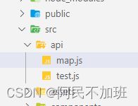
- 创建map.js
- getParkList方法
- 移动端控制台插件
- 四、编写components组件
-
- 在main.js中引入全局组件
- 在main.js中挂载计算距离js方法
- 总结
前言
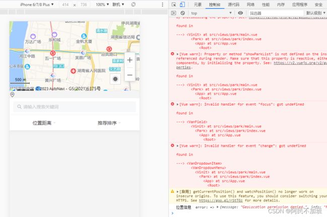
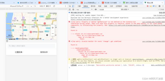
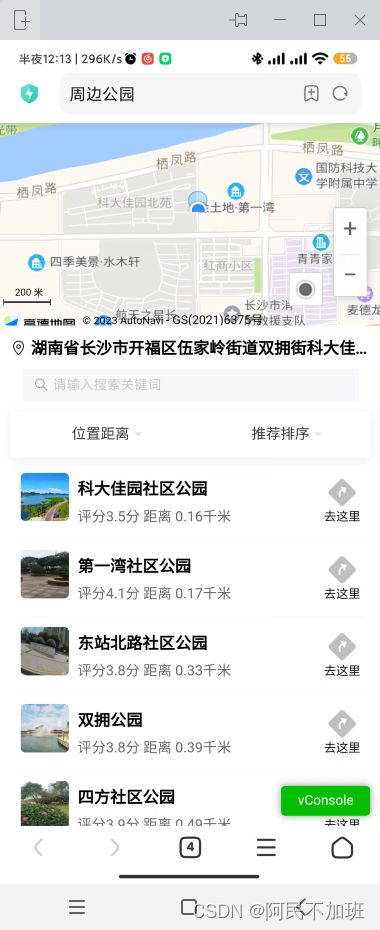
实现样式效果如图,比较复杂,内容较多。会在api文件夹创建接口,会在components写一个组件,阅读大概10分钟
一、编写页面内容+样式
1.1 html内容
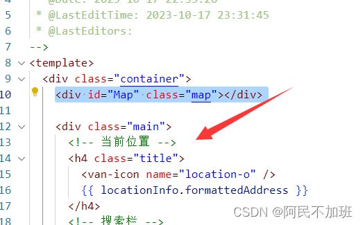
复制这块,放在 地图的div下面
<div class="main">

  <h4 class="title">
    <van-icon name="location-o" />
    {{ locationInfo.formattedAddress }}
  h4>

  <van-search v-model="input" placeholder="请输入搜索关键词" readonly @focus="onJumpSearch" />

  <van-dropdown-menu>
    <van-dropdown-item title="位置距离" v-model="radius" :options="radiusList" @change="getParkList" />
    <van-dropdown-item title="推荐排序" v-model="type" :options="typeList" />
  van-dropdown-menu>

  <section class="park-list">
    <map-item v-for="item in showParkList" :key="item.id" :item="item">
      <p>
        评分{{ item.biz_ext.rating }}分 距离
        {{
          getDistances(position[1], position[0], item.location.split(',')[1], item.location.split(',')[0]).km
        }}千米
      p>
    map-item>
  section>
div>
1.2 css内容
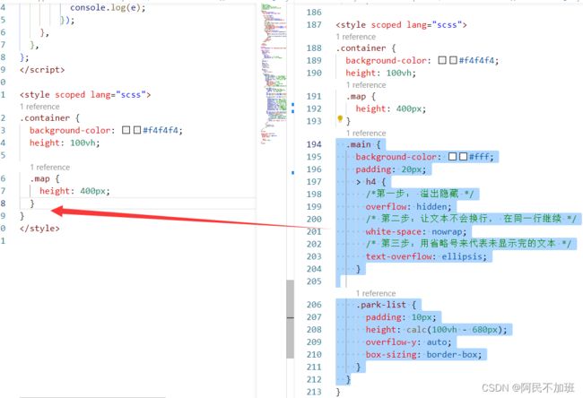
复制放在 .map 后面
.main {
  background-color: #fff;
  padding: 20px;
  > h4 {
    /*第一步: 溢出隐藏 */
    overflow: hidden;
    /* 第二步:让文本不会换行, 在同一行继续 */
    white-space: nowrap;
    /* 第三步:用省略号来代表未显示完的文本 */
    text-overflow: ellipsis;
  }
  .park-list {
    padding: 10px;
    height: calc(100vh - 680px);
    overflow-y: auto;
    box-sizing: border-box;
  }
}
解决报错
二、完善api接口+变量+方法
1.data变量
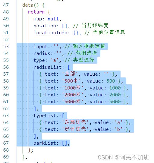
代码如下(示例):
input: '', // 输入框绑定值
radius: '', // 范围选择
type: 'a', // 类型选择
radiusList: [
  { text: '全部', value: '' },
  { text: '500米', value: 500 },
  { text: '1000米', value: 1000 },
  { text: '2000米', value: 2000 },
  { text: '5000米', value: 5000 },
],
typeList: [
  { text: '距离优先', value: 'a' },
  { text: '好评优先', value: 'b' },
],
parkList: [],
2. methods
代码如下(示例):
    onJumpSearch() {
      this.$router.push('/park/search');
    },
    onJumpDetail(id) {
      this.$router.push('/park/detail/' + id);
    },
3. computed
这个showParkList是我用于渲染页面的parkList,由于高德地图没有条件查询,它只有按照距离来,所以我只能,按距离查询到之后,自己用里面的参数进行一遍过滤。
computed: {
    showParkList() {
      let array = [...this.parkList];
      if (this.type === 'a') {
        return array;
      } else if (this.type === 'b') {
        return array.sort((a, b) => {
          // 使用parseFloat将rating属性的值解析为数字
          const ratingA = parseFloat(a.biz_ext.rating);
          const ratingB = parseFloat(b.biz_ext.rating);
          // 根据rating属性从大到小排序
          return ratingB - ratingA;
        });
      }
    },
  },
4. api接口方法
三、配置api接口方法
由于东西太多,开一个新标题、
创建map.js
// 我使用的poi是1.0,不是2.0, 2.0的话后缀是v5
import axios from 'axios';
import Vue from 'vue';

const baseUrl = 'https://restapi.amap.com/v3';
axios.defaults.headers.common['key'] = Vue.prototype.mapServiceKey;

// 周边搜索
export function mapPlaceAround(params) {
  return new Promise((resolve, reject) => {
    axios({
      method: 'get',
      url: baseUrl + '/place/around',
      params,
    })
      .then((res) => {
        resolve(res.data);
      })
      .catch((err) => {
        reject(err);
      });
  });
}
// 关键字搜索
export function mapPlaceText(params) {
  return new Promise((resolve, reject) => {
    axios({
      method: 'get',
      url: baseUrl + '/place/text',
      params,
    })
      .then((res) => {
        resolve(res.data);
      })
      .catch((err) => {
        reject(err);
      });
  });
}
// 查询地点详情
export function mapPlaceDetail(params) {
  return new Promise((resolve, reject) => {
    axios({
      method: 'get',
      url: baseUrl + '/place/detail',
      params,
    })
      .then((res) => {
        resolve(res.data);
      })
      .catch((err) => {
        reject(err);
      });
  });
}
我已经都封装好了,直接复制粘贴
getParkList方法
复制放到export default上面
import { mapPlaceAround } from '@/api/map';
复制粘贴放到methods里面
getParkList() {
  console.log('查询');
  mapPlaceAround({
    location: this.position.join(','), // 当前经纬度拼接, 需要格式为 '113.110748,28.246296'
    keywords: '公园',
    types: '080000|110000', // 体育休闲服务|风景名胜
    radius: this.radius, // 距离
    page: 1,
    offset: 20,
    extensions: 'all', // all全部信息, base基础信息
  }).then((res) => {
    this.parkList = res.pois;
    console.log(JSON.parse(JSON.stringify(res.pois)));
  });
},
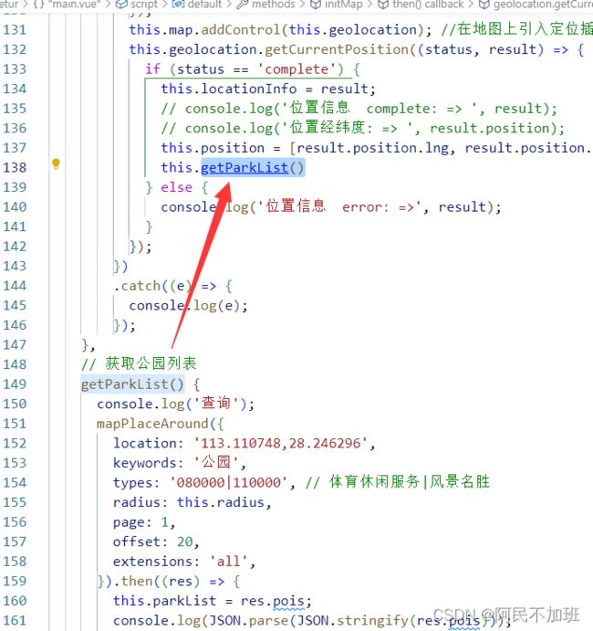
在获取到定位的时候去调用this.getParkList()方法
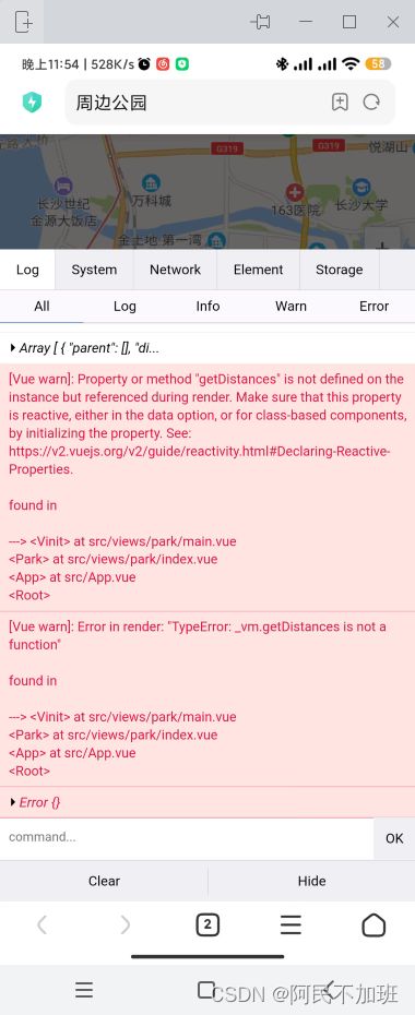
移动端控制台插件
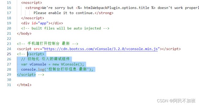
把这段代码放在public下的index.html中,你的项目就会有一个控制台了,在手机端测试的时候就可以看见网络请求和控制台打印了
<script src="https://cdn.bootcss.com/vConsole/3.2.0/vconsole.min.js">script>
<script>
  // 初始化 引入的调试组件
  var vConsole = new VConsole();
  console.log('控制台打印信息 最新');
script>
四、编写components组件
这里直接复制粘贴我的了,懒得说明了,样式拿去用就随便改改吧。
在components中创建文件夹 MapItem,再创建index.vue
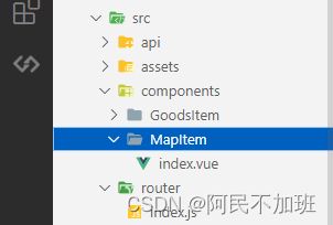
<template>
  <div class="com-map-item" v-if="item">
    <div class="img">
      <van-image v-if="item.photos.length > 0" width="50" height="50" :src="item.photos[0].url" />
      <van-image v-else width="50" height="50" fit="cover" :src="require('@/assets/images/park.png')" />
      <slot name="top">slot>
    div>
    <div class="park-name" @click="onJumpDetail(item.id)">
      <h4>{{ item.name }}h4>
      <slot>slot>
    div>
    <div class="park-right" @click="onJumpView">
      <van-image width="30" height="30" :src="require('@/assets/images/icons/toRight.png')" />
      <span>去这里span>
    div>
  div>
template>

<script>
export default {
  name: 'vinit',
  props: {
    item: {
      type: Object,
      default: () => {},
    },
    position: {
      type: Array,
      default: () => [],
    },
  },
  data() {
    return {};
  },
  computed: {},
  watch: {},
  filters: {},
  created() {},
  methods: {
    onJumpDetail(id) {
      this.$router.push('/park/detail/' + id);
    },
    onJumpView() {
      this.$router.push('/park/view/' + this.item.id);
    },
  },
};
script>

<style scoped lang="scss">
.com-map-item {
  position: relative;
  display: flex;
  align-items: center;
  justify-content: space-between;
  padding: 20px 10px;
  border-bottom: 1px solid #eee;
  .img {
    position: relative;
  }

  ::v-deep .van-image__img {
    border-radius: 5px;
  }
  .park-name {
    width: 70%;
    p {
      color: #666;
      font-size: 28px;
      margin-top: 10px;
      /*第一步: 溢出隐藏 */
      overflow: hidden;
      /* 第二步:让文本不会换行, 在同一行继续 */
      white-space: nowrap;
      /* 第三步:用省略号来代表未显示完的文本 */
      text-overflow: ellipsis;
    }
  }
  .park-right {
    display: flex;
    flex-direction: column;
    align-items: center;
  }
}
style>
把MapItem挂载全局,你要按需引入也可以
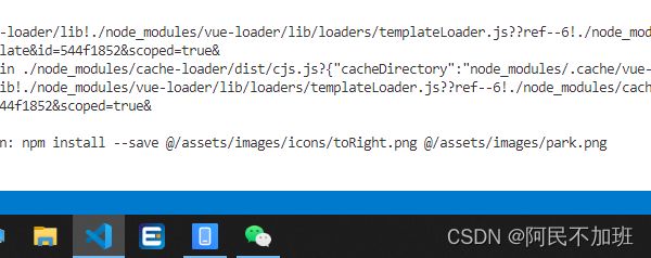
代码中需要用到图片,缺少图片请看下一步
在main.js中引入全局组件
// 地图列表item
import MapItem from '@/components/MapItem';
Vue.component('MapItem', MapItem);
这里你可以自己修改,如果怕出错,那就用我的,不过这个也简单
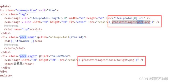
图片随便找一个图标叫 toRight.png
一个叫park.png
图标网站传送门iconfont-阿里巴巴矢量图标库
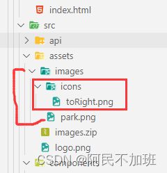
图标在icons里面,图片在images里面,或者你自己改也行。反正是组件。
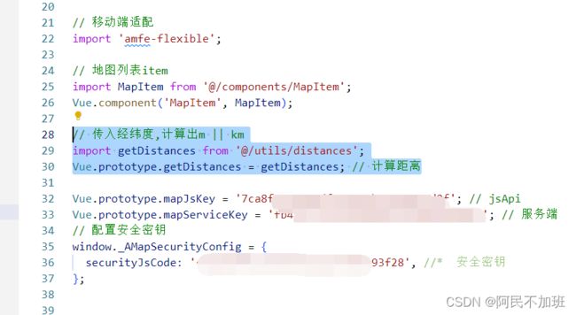
在main.js中挂载计算距离js方法
还是报错,因为没有计算距离方法
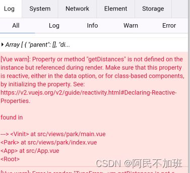
在utils中创建 distances.js
// 根据经纬度计算距离,参数分别为第一点的纬度,经度;第二点的纬度,经度
function getDistances(lat1, lng1, lat2, lng2) {
  let EARTH_RADIUS = 6378.137; // 地球半径
  let radLat1 = (lat1 * Math.PI) / 180.0; //lat1 * Math.PI / 180.0=>弧度计算
  let radLat2 = (lat2 * Math.PI) / 180.0;
  let a = radLat1 - radLat2;
  let b = (lng1 * Math.PI) / 180.0 - (lng2 * Math.PI) / 180.0;
  let s =
    2 *
    Math.asin(
      Math.sqrt(Math.pow(Math.sin(a / 2), 2) + Math.cos(radLat1) * Math.cos(radLat2) * Math.pow(Math.sin(b / 2), 2))
    );
  s = s * EARTH_RADIUS;
  s = Math.round(s * 10000) / 10000; // 输出为公里
  return { m: Math.round(s * 1000), km: Number(s.toFixed(2)) };
}
export default getDistances;
在main.js中
// 传入经纬度,计算出m || km
import getDistances from '@/utils/distances';
Vue.prototype.getDistances = getDistances; // 计算距离
总结
提示:这里对文章进行总结:
挂载了计算距离方法后,发现页面不报错了,正常运行了
- 为什么不用webJs的poi查询?那个查询可以直接在地图上标点出来。
因为没有我所需要的评分,我需要根据评分来排序,如果需要地图显示点,可以用mark批量添加,看到这里相信你已经会基本操作了。mark加标记点我在后面会有一片教程,不过不是批量,不过都差不多,反正都是给经纬度然后整个循环。
如果看到这里还是没有正常运行。
请检查
- data变量
- computed计算属性
- methods方法
- import引入js请求方法
- main.js挂载计算距离方法
- api文件夹下创建map.js方法
- components组件,挂载到main.js全局,并且需要2张图片
- 在获取定位后,执行getParkList方法
