全面认知 Google Earth免费版与收费版差异
http://whx.tzgt.gov.cn/newOperate/html/5/53/531/9085.html
Google Earth一共提供了三个版本(不含企业服务器版):个人<nobr><a class="iAs" oncontextmenu="return false;" onmousemove="kwM(-8);" id="key7" onmouseover="kwE(event,-8, this);" style="COLOR: #6600ff; BORDER-BOTTOM: #6600ff 0px dotted; BACKGROUND-COLOR: transparent; TEXT-DECORATION: underline" onclick="return kwC();" onmouseout="kwL(event, this);" target="_blank">免费</a></nobr>版、Plus版、Pro版。
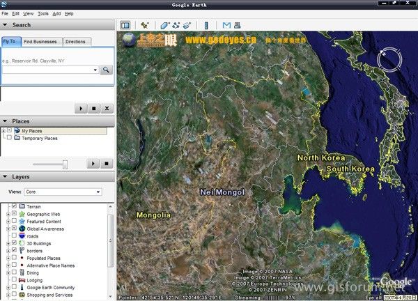
Google Earth 免费版
“献给每一个渴望飞翔的梦想...For anyone who has ever dreamed of flying...” - NY Times
这是一个很简单的想法--将地球装到您的电脑中,您可以轻移鼠标便可探索和查看任何您感兴趣的地方、将卫星拍摄的影像与区域细节放大显示、通过Google Search来查阅某个区域的具体情况、查看通往某个旅馆的道路该如何行走甚至沿着该线路模拟地走上一遍...现在这些都成为了事实!
Google Earth对个人用户而言是完全免费的,无须注册。但您可以随时选择升级到Google Earth Plus版。(目前看来意义不大!)

功能特点
对个人用户而言完全免费;
成熟的数据流技术保证了只传递给您指定的区域数据;
提供了全球的地貌影像与3D数据--总计大于1000GB的针对城市的高精度卫星拍摄的影像;
区域查找能让您查询餐馆、旅馆和行车线路。还能将<nobr><a class="iAs" oncontextmenu="return false;" onmousemove="kwM(-7);" id="key6" onmouseover="kwE(event,-7, this);" style="COLOR: #6600ff; BORDER-BOTTOM: #6600ff 1px dotted; BACKGROUND-COLOR: transparent; TEXT-DECORATION: underline" onclick="return kwC();" onmouseout="kwL(event, this);" target="_blank">建筑</a></nobr>物进行精确的模拟3D演示,并使用多图层功能灵活查询、保存搜索结果。
能分别单独显示各公园、学校、医院、机场和<nobr><a class="iAs" oncontextmenu="return false;" onmousemove="kwM(0);" id="key0" onmouseover="kwE(event,0, this);" style="COLOR: #6600ff; BORDER-BOTTOM: #6600ff 1px dotted; BACKGROUND-COLOR: transparent; TEXT-DECORATION: underline" onclick="return kwC();" onmouseout="kwL(event, this);" target="_blank">商场</a></nobr>等的图层功能;
KML书签分享--提供地点书签记录功能,并且允许导入和导出,这使得GE的使用交流会更加便利;
在最新版本中Google Earth免费版开放了部分Plus版本的功能,比如注释提供草图简绘功能(点、线、面的标注);
使用它可以为您:
为<nobr><a class="iAs" oncontextmenu="return false;" onmousemove="kwM(-1);" id="key1" onmouseover="kwE(event,-1, this);" style="COLOR: #6600ff; BORDER-BOTTOM: #6600ff 1px dotted; BACKGROUND-COLOR: transparent; TEXT-DECORATION: underline" onclick="return kwC();" onmouseout="kwL(event, this);" target="_blank">旅游</a></nobr>出行做精确、直观的计划安排;
获知各种交通线路示意图;
查询某栋建筑物;
查询某些区域的<nobr><a class="iAs" oncontextmenu="return false;" onmousemove="kwM(-2);" id="key2" onmouseover="kwE(event,-2, this);" style="COLOR: #6600ff; BORDER-BOTTOM: #6600ff 1px dotted; BACKGROUND-COLOR: transparent; TEXT-DECORATION: underline" onclick="return kwC();" onmouseout="kwL(event, this);" target="_blank">商务</a></nobr>情况;
神奇地探索地球;
Google Earth Plus
从Google Earth升级到Google Earth Plus是自愿的,升级的费用为20美金/年。要升级到Google Earth Plus,下载并运行Google Earth后,在菜单 help 中选择 upgrade 即可。

升级到Google Earth Plus有什么好处?
GPS 数据接口导入--从GPS设备中导入线路行车内容;
注意1.目前仅支持Magellan和Garmin设备;
注意2.不支持将线路行车内容导出到GPS设备;
影像高精度打印(高于显示器屏幕分辨率);
Email<nobr><a class="iAs" oncontextmenu="return false;" onmousemove="kwM(-6);" id="key5" onmouseover="kwE(event,-6, this);" style="COLOR: #6600ff; BORDER-BOTTOM: #6600ff 1px dotted; BACKGROUND-COLOR: transparent; TEXT-DECORATION: underline" onclick="return kwC();" onmouseout="kwL(event, this);" target="_blank">客户服务</a></nobr>(问题解答等)支持;
注释提供草图简绘功能,这可以定义出更直观的书签与注释,并通过KML来分享;
通过csv文件来实现数据输入;
Google Earth Pro
适合于专业人员与商业用途
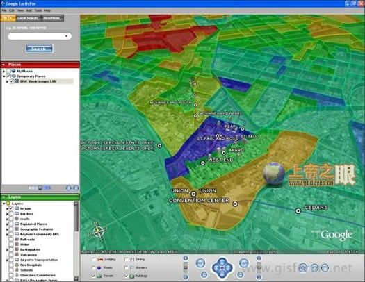
Google Earth Pro会使得区域调查与表述成为一件很简单的事情。输入目的地址,您可以观看Google Earth从出发地一直飞驰到目的地,并且以3D模式形式显示沿途的商业机构、<nobr><a class="iAs" oncontextmenu="return false;" onmousemove="kwM(-9);" id="key8" onmouseover="kwE(event,-9, this);" style="COLOR: #6600ff; BORDER-BOTTOM: #6600ff 1px dotted; BACKGROUND-COLOR: transparent; TEXT-DECORATION: underline" onclick="return kwC();" onmouseout="kwL(event, this);" target="_blank">学校</a></nobr>、商场等,将一座城市的模拟记录导出制作成视频格式,并将这些显示记录保存下来与同事或客户分享。我们提供了Google Earth Pro版本的七天试用。

功能特点:
成熟的数据流技术保证了只传递给您指定的区域数据;
提供了全球的地貌影像与3D数据--总计大于1000GB的针对城市的高精度卫星拍摄的影像;
区域查找能让您查询餐馆、旅馆和行车线路。还能将建筑物进行精确的模拟3D演示,并使用多图层功能灵活查询、保存搜索结果。
能分别单独显示各公园、学校、医院、机场和商场等的图层功能;
通过导入道路和建筑物位置信息来<nobr><a class="iAs" oncontextmenu="return false;" onmousemove="kwM(-5);" id="key4" onmouseover="kwE(event,-5, this);" style="COLOR: #6600ff; BORDER-BOTTOM: #6600ff 1px dotted; BACKGROUND-COLOR: transparent; TEXT-DECORATION: underline" onclick="return kwC();" onmouseout="kwL(event, this);" target="_blank">设计</a></nobr>草图,为绘制为建筑蓝图;
能以线条和多边图形制作注释;
通过电子表格批量升级到超过2500个区域的位置信息;
KML书签分享--提供地点书签记录功能,并且允许导入和导出,这使得GE的使用交流会更加便利;
附加功能的费用:
视频电影生成模块 200美金/年
生成的视频格式为wmv
样本文件下载 http://services.google.com/earth/SampleMovie.wmv
高精度打印模块 200美金/年
支持11" x 17" (英寸)的打印分辨率
样本文件下载 http://earth.google.com/images/sampleprint.jpg
GIS数据导入模块 200美金/年
以shp、tab格式合并导入的GIS数据;
GDT交通计量数据 200美金/年
从GDT中增加交通计量<nobr><a class="iAs" oncontextmenu="return false;" onmousemove="kwM(-3);" id="key3" onmouseover="kwE(event,-3, this);" style="COLOR: #6600ff; BORDER-BOTTOM: #6600ff 1px dotted; BACKGROUND-COLOR: transparent; TEXT-DECORATION: underline" onclick="return kwC();" onmouseout="kwL(event, this);" target="_blank">统计</a></nobr>功能
样本文件下载 http://earth.google.com/images/traffic.jpg
NRB商业中心数据 200美金/年
样本文件下载 http://earth.google.com/images/nrb.jpg
<!--endprint-->