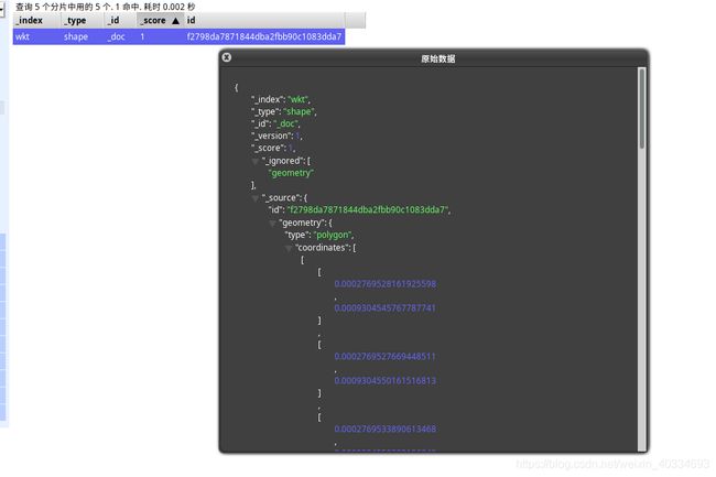
基于es出现的地理数据插入报错解决方案
基于es出现的地理数据插入报错解决方案
这里出的错误是es中常见的geo_shape类型的插入出现:
- 话不多说直接上mapping
curl XPOST
{
  "mappings": {
    "shape": {
      "_all": {
        "enabled": false
      },
      "properties": {
        "id": {
          "type": "keyword"
        },
        "geometry": {
          "type": "geo_shape",
          "tree": "geohash",
          "strategy": "recursive"
        }
      }
    }
  }
}
-
接下来是一条示例:
-
{ "id": "f2798da7871844dba2fbb90c1083dda7", "geometry": { "type": "polygon", "coordinates": [ [ [ 0.0002769528161925598, 0.0009304545767787741 ], [ 0.0002769527669448511, 0.0009304550161516813 ], [ 0.0002769533890613468, 0.0009304550383106249 ], [ 0.0002769531007758705, 0.0009304583324129131 ], [ 0.0002769423377915506, 0.0009304574434056005 ], [ 0.0002769432171131423, 0.0009304453496413198 ], [ 0.0002769551191177047, 0.000930446170991552 ], [ 0.00027695477228457775, 0.0009304514541992943 ], [ 0.00027694355159299484, 0.0009304505149532853 ], [ 0.00027694336741343435, 0.0009304520513151477 ], [ 0.0002769483570040075, 0.0009304525457815098 ], [ 0.00027695604579139446, 0.0009304532132122362 ], [ 0.00027695595623969686, 0.0009304549064620671 ], [ 0.0002769528161925598, 0.0009304545767787741 ], [ 0.0002769540439121113, 0.0009304496469345285 ], [ 0.0002769541751036308, 0.00093044776834636 ], [ 0.00027694379304798403, 0.000930447100484332 ], [ 0.0002769436605715204, 0.0009304488617795905 ], [ 0.0002769540439121113, 0.0009304496469345285 ] ] ] } }- 这里插入的时候就会有以下错误
  {

      "error": {
          "root_cause": [
              {
                  "type": "parse_exception",
                  "reason": "invalid LinearRing found (coordinates are not closed)"
              }
          ],
          "type": "mapper_parsing_exception",
          "reason": "failed to parse field [geometry] of type [geo_shape]",
          "caused_by": {
              "type": "parse_exception",
              "reason": "invalid LinearRing found (coordinates are not closed)"
          }
      },
      "status": 400

  }
请注意这里其实是有解决方案的,具体可以在github上,这里我一并列出来:
11161
在这里重点已经说明了,其实是因为es中由于对建筑物的要求过高,导致面数据插入过程中异常信息,从而得到了我们上面遇到的错误,这里也给出了解决方案,就是这句话:
ignore_malformed- don’t throw an exception if the data is malformed, but just ignore this field value
就是这句话,很重要,这里说明了,只有加入这个字段之后,才能正常插入.
官网里面也给出了相关的解释:
Trying to index the wrong datatype into a field throws an exception by default, and rejects the whole document. The ignore_malformed parameter, if set to true, allows the exception to be ignored. The malformed field is not indexed, but other fields in the document are processed normally.
所以这里其实并不是数据的问题,其实是es中的问题,所以现在我们重新加入之后开始尝试一下:
curl XPOST
{
    "mappings": {
        "shape": {
            "_all": {
                "enabled": false
            },
            "properties": {
                "id": {
                    "type": "keyword"
                },
                "geometry": {
                    "type": "geo_shape",
                    "tree": "geohash",
                    "strategy": "recursive",
                    "ignore_malformed": true
                }
            }
        }
    }
}
这里再插入一遍,你就会得到如下的结果:
{

    "_index": "wkt",
    "_type": "shape",
    "_id": "_doc",
    "_version": 1,
    "result": "created",
    "_shards": {
        "total": 2,
        "successful": 1,
        "failed": 0
    },
    "_seq_no": 0,
    "_primary_term": 1

}
