java 实现搜索附近人功能
方案一:
现在很多手机软件都用附近搜索功能,但具体是怎么实现的呢》
在网上查了很多资料,mysql空间数据库、矩形算法、geohash我都用过了,当数据上了百万之后mysql空间数据库方法是最强最精确的(查询前100条数据只需5秒左右)。
接下来推出一个原创计算方法,查询速度是mysql空间数据库算法的2倍
$lng是你的经度,$lat是你的纬度
SELECT lng,lat,
        (POWER(MOD(ABS(lng - $lng),360),2) + POWER(ABS(lat - $lat),2)) AS distance
        FROM `user_location`
ORDER BY distance LIMIT 100####################################
另外的几种算法还是在这里展示一下:
一、距形算法
define(EARTH_RADIUS, 6371);//地球半径,平均半径为6371km
 /**
 *计算某个经纬度的周围某段距离的正方形的四个点
 *
 *@param lng float 经度
 *@param lat float 纬度
 *@param distance float 该点所在圆的半径,该圆与此正方形内切,默认值为0.5千米
 *@return array 正方形的四个点的经纬度坐标
 */
 function returnSquarePoint($lng, $lat,$distance = 0.5){

    $dlng =  2 * asin(sin($distance / (2 * EARTH_RADIUS)) / cos(deg2rad($lat)));
    $dlng = rad2deg($dlng);

    $dlat = $distance/EARTH_RADIUS;
    $dlat = rad2deg($dlat);

    return array(
                'left-top'=>array('lat'=>$lat + $dlat,'lng'=>$lng-$dlng),
                'right-top'=>array('lat'=>$lat + $dlat, 'lng'=>$lng + $dlng),
                'left-bottom'=>array('lat'=>$lat - $dlat, 'lng'=>$lng - $dlng),
                'right-bottom'=>array('lat'=>$lat - $dlat, 'lng'=>$lng + $dlng)
                );
 }
//使用此函数计算得到结果后,带入sql查询。
$squares = returnSquarePoint($lng, $lat);
$info_sql = "select id,locateinfo,lat,lng from `lbs_info` where lat<>0 and lat>{$squares['right-bottom']['lat']} and lat<{$squares['left-top']['lat']} and lng>{$squares['left-top']['lng']} and lng<{$squares['right-bottom']['lng']} ";
java代码如下:
/**
     * 默认地球半径
     */
    private static double EARTH_RADIUS = 6371;

    /**
     * 计算经纬度点对应正方形4个点的坐标
     *
     * @param longitude
     * @param latitude
     * @param distance
     * @return
     */
    public static Map returnLLSquarePoint(double longitude,
            double latitude, double distance) {
        Map squareMap = new HashMap();
        // 计算经度弧度,从弧度转换为角度
        double dLongitude = 2 * (Math.asin(Math.sin(distance
                / (2 * EARTH_RADIUS))
                / Math.cos(Math.toRadians(latitude))));
        dLongitude = Math.toDegrees(dLongitude);
        // 计算纬度角度
        double dLatitude = distance / EARTH_RADIUS;
        dLatitude = Math.toDegrees(dLatitude);
        // 正方形
        double[] leftTopPoint = { latitude + dLatitude, longitude - dLongitude };
        double[] rightTopPoint = { latitude + dLatitude, longitude + dLongitude };
        double[] leftBottomPoint = { latitude - dLatitude,
                longitude - dLongitude };
        double[] rightBottomPoint = { latitude - dLatitude,
                longitude + dLongitude };
        squareMap.put("leftTopPoint", leftTopPoint);
        squareMap.put("rightTopPoint", rightTopPoint);
        squareMap.put("leftBottomPoint", leftBottomPoint);
        squareMap.put("rightBottomPoint", rightBottomPoint);
        return squareMap;
} 以下location字段是跟据经纬度来生成的空间数据,如:
location字段的type设为point
"update feed set location=GEOMFROMTEXT('point({$lat} {$lng})') where id='{$id}'"
mysql空间数据查询
SET @center = GEOMFROMTEXT('POINT(35.801559 -10.501577)');
        SET @radius = 4000;
        SET @bbox = CONCAT('POLYGON((',
        X(@center) - @radius, ' ', Y(@center) - @radius, ',',
        X(@center) + @radius, ' ', Y(@center) - @radius, ',',
        X(@center) + @radius, ' ', Y(@center) + @radius, ',',
        X(@center) - @radius, ' ', Y(@center) + @radius, ',',
        X(@center) - @radius, ' ', Y(@center) - @radius, '))'
        );
SELECT id,lng,lat,
        SQRT(POW( ABS( X(location) - X(@center)), 2) + POW( ABS(Y(location) - Y(@center)), 2 )) AS distance
        FROM `user_location` WHERE 1=1
        AND INTERSECTS( location, GEOMFROMTEXT(@bbox) )
        AND SQRT(POW( ABS( X(location) - X(@center)), 2) + POW( ABS(Y(location) - Y(@center)), 2 )) < @radius
        ORDER BY distance LIMIT 20
geo算法
参考文档:
http://blog.csdn.net/wangxiafghj/article/details/9014363geohash 算法原理及实现方式
http://blog.charlee.li/geohash-intro/ geohash:用字符串实现附近地点搜索
http://blog.sina.com.cn/s/blog_7c05385f0101eofb.html 查找附近点--Geohash方案讨论
http://www.wubiao.info/372 查找附近的xxx 球面距离以及Geohash方案探讨
http://en.wikipedia.org/wiki/Haversine_formula Haversine formula球面距离公式
http://www.codecodex.com/wiki/Calculate_Distance_Between_Two_Points_on_a_Globe 球面距离公式代码实现
http://developer.baidu.com/map/jsdemo.htm#a6_1 球面距离公式验证
http://www.wubiao.info/470 Mysql or Mongodb LBS快速实现方案
geohash有以下几个特点:
首先,geohash用一个字符串表示经度和纬度两个坐标。某些情况下无法在两列上同时应用索引 (例如MySQL 4之前的版本,Google App Engine的数据层等),利用geohash,只需在一列上应用索引即可。
其次,geohash表示的并不是一个点,而是一个矩形区域。比如编码wx4g0ec19,它表示的是一个矩形区域。 使用者可以发布地址编码,既能表明自己位于北海公园附近,又不至于暴露自己的精确坐标,有助于隐私保护。
第三,编码的前缀可以表示更大的区域。例如wx4g0ec1,它的前缀wx4g0e表示包含编码wx4g0ec1在内的更大范围。 这个特性可以用于附近地点搜索。首先根据用户当前坐标计算geohash(例如wx4g0ec1)然后取其前缀进行查询 (SELECT * FROM place WHERE geohash LIKE 'wx4g0e%'),即可查询附近的所有地点。
查找附近网点geohash算法及实现 (Java版本),geohashjava
Geohash比直接用经纬度的高效很多。
Geohash算法实现(Java版本)
package com.DistTest;
import java.util.BitSet;
import java.util.HashMap;

public class Geohash {

        private static int numbits = 6 * 5;
        final static char[] digits = { '0', '1', '2', '3', '4', '5', '6', '7', '8',
                        '9', 'b', 'c', 'd', 'e', 'f', 'g', 'h', 'j', 'k', 'm', 'n', 'p',
                        'q', 'r', 's', 't', 'u', 'v', 'w', 'x', 'y', 'z' };

        final static HashMap lookup = new HashMap();
        static {
                int i = 0;
                for (char c : digits)
                        lookup.put(c, i++);
        }

        public double[] decode(String geohash) {
                StringBuilder buffer = new StringBuilder();
                for (char c : geohash.toCharArray()) {

                        int i = lookup.get(c) + 32;
                        buffer.append( Integer.toString(i, 2).substring(1) );
                }

                BitSet lonset = new BitSet();
                BitSet latset = new BitSet();

                //even bits
                int j =0;
                for (int i=0; i< numbits*2;i+=2) {
                        boolean isSet = false;
                        if ( i < buffer.length() )
                          isSet = buffer.charAt(i) == '1';
                        lonset.set(j++, isSet);
                }

                //odd bits
                j=0;
                for (int i=1; i< numbits*2;i+=2) {
                        boolean isSet = false;
                        if ( i < buffer.length() )
                          isSet = buffer.charAt(i) == '1';
                        latset.set(j++, isSet);
                }
               //中国地理坐标:东经73°至东经135°,北纬4°至北纬53°
                double lon = decode(lonset, 70, 140);
                double lat = decode(latset, 0, 60);

                return new double[] {lat, lon};
        }

        private double decode(BitSet bs, double floor, double ceiling) {
                double mid = 0;
                for (int i=0; i= mid) {
                                buffer.set(i);
                                floor = mid;
                        } else {
                                ceiling = mid;
                        }
                }
                return buffer;
        }

        public static String base32(long i) {
                char[] buf = new char[65];
                int charPos = 64;
                boolean negative = (i < 0);
                if (!negative)
                        i = -i;
                while (i <= -32) {
                        buf[charPos--] = digits[(int) (-(i % 32))];
                        i /= 32;
                }
                buf[charPos] = digits[(int) (-i)];

                if (negative)
                        buf[--charPos] = '-';
                return new String(buf, charPos, (65 - charPos));
        }

}
球面距离公式:
package com.DistTest;
public class Test{
    private static final  double EARTH_RADIUS = 6371000;//赤道半径(单位m)

    /**
     * 转化为弧度(rad)
     * */
    private static double rad(double d)
    {
       return d * Math.PI / 180.0;
    }
    /**
     * 基于googleMap中的算法得到两经纬度之间的距离,计算精度与谷歌地图的距离精度差不多,相差范围在0.2米以下
     * @param lon1 第一点的精度
     * @param lat1 第一点的纬度
     * @param lon2 第二点的精度
     * @param lat3 第二点的纬度
     * @return 返回的距离,单位m
     * */
    public static double GetDistance(double lon1,double lat1,double lon2, double lat2)
    {
       double radLat1 = rad(lat1);
       double radLat2 = rad(lat2);
       double a = radLat1 - radLat2;
       double b = rad(lon1) - rad(lon2);
       double s = 2 * Math.asin(Math.sqrt(Math.pow(Math.sin(a/2),2)+Math.cos(radLat1)*Math.cos(radLat2)*Math.pow(Math.sin(b/2),2)));
       s = s * EARTH_RADIUS;
       s = Math.round(s * 10000) / 10000;
       return s;
    }

    public static void main(String []args){
          double lon1=109.0145193757;
          double lat1=34.236080797698;
          double lon2=108.9644583556;
          double lat2=34.286439088548;
          double dist;
          String geocode;

          dist=Test.GetDistance(lon1, lat1, lon2, lat2);
          System.out.println("两点相距:" + dist + " 米");


          Geohash geohash = new Geohash();
          geocode=geohash.encode(lat1, lon1);
          System.out.println("当前位置编码:" + geocode);

          geocode=geohash.encode(lat2, lon2);
          System.out.println("远方位置编码:" + geocode);

       }
    //wqj7j37sfu03h2xb2q97
    /*
永相逢超市
108.83457500177
34.256981052624
wqj6us6cmkj5bbfj6qdg
s6q08ubhhuq7
*/
}
附近网点距离排序
package com.DistTest;

import java.sql.DriverManager;
import java.sql.ResultSet;
import java.sql.SQLException;
import java.sql.Connection;
import java.sql.Statement;


public class sqlTest {

    public static void main(String[] args) throws Exception {
        Connection conn = null;
        String sql;
        String url = "jdbc:mysql://132.97.**.**/test?"
                + "user=***&password=****&useUnicode=true&characterEncoding=UTF8";

        try {
            Class.forName("com.mysql.jdbc.Driver");// 动态加载mysql驱动
            // System.out.println("成功加载MySQL驱动程序");
            // 一个Connection代表一个数据库连接
            conn = DriverManager.getConnection(url);
            // Statement里面带有很多方法,比如executeUpdate可以实现插入,更新和删除等
            Statement stmt = conn.createStatement();
            sql = "select * from retailersinfotable limit 1,10";
            ResultSet rs = stmt.executeQuery(sql);// executeQuery会返回结果的集合,否则返回空值
              double lon1=109.0145193757;
              double lat1=34.236080797698;
            System.out.println("当前位置:");
            int i=0;
            String[][] array = new String[10][3];
            while (rs.next()){
                    //从数据库取出地理坐标
                    double lon2=Double.parseDouble(rs.getString("Longitude"));
                    double lat2=Double.parseDouble(rs.getString("Latitude"));

                    //根据地理坐标,生成geohash编码
                      Geohash geohash = new Geohash();
                    String geocode=geohash.encode(lat2, lon2).substring(0, 9);

                    //计算两点间的距离
                      int dist=(int) Test.GetDistance(lon1, lat1, lon2, lat2);

                      array[i][0]=String.valueOf(i);
                    array[i][1]=geocode;
                    array[i][2]=Integer.toString(dist);

                      i++;

                //    System.out.println(lon2+"---"+lat2+"---"+geocode+"---"+dist);
                }

            array=sqlTest.getOrder(array); //二维数组排序
            sqlTest.showArray(array);        //打印数组


        } catch (SQLException e) {
            System.out.println("MySQL操作错误");
            e.printStackTrace();
        } finally {
            conn.close();
        }

    }
    /*
     * 二维数组排序,比较array[][2]的值,返回二维数组
     * */
    public static String[][] getOrder(String[][] array){
        for (int j = 0; j < array.length ; j++) {
            for (int bb = 0; bb < array.length - 1; bb++) {
                String[] ss;
                int a1=Integer.valueOf(array[bb][2]);  //转化成int型比较大小
                int a2=Integer.valueOf(array[bb+1][2]);
                if (a1>a2) {
                    ss = array[bb];
                    array[bb] = array[bb + 1];
                    array[bb + 1] = ss;

                }
            }
        }
        return array;
    }

    /*打印数组*/
    public static void showArray(String[][] array){
          for(int a=0;a
一直在琢磨LBS,期待可以发现更好的方案。现在纠结了。
简单列举一下已经了解到的方案:
1.sphinx geo索引
2.mongodb geo索引
3.mysql sql查询
4.mysql+geohash
5.redis+geohash
然后列举一下需求:
1.实时性要高,有频繁的更新和读取
2.可按距离排序支持分页
3.支持多条件筛选(一个经纬度数据还包含其他属性,比如社交系统的性别、年龄)
方案简单介绍:
1.sphinx geo索引
支持按照距离排序,并支持分页。但是尝试mva+geo失败,还在找原因。
无法满足高实时性需求。(可能是不了解实时增量索引配置有误)
资源占用小,速度快
2.mongodb geo索引
支持按照距离排序,并支持分页。支持多条件筛选。
可满足实时性需求。
资源占用大,数据量达到百万级请流量在10w左右查询速度明显下降。
3.mysql+geohash/ mysql sql查询
不支持按照距离排序(代价太大)。支持分页。支持多条件筛选。
可满足实时性需求。
资源占用中等,查询速度不及mongodb。
且geohash按照区块将球面转化平面并切割。暂时没有找到跨区块查询方法(不太了解)。
4.redis+geohash
geohash缺点不再赘述
不支持距离排序。支持分页查询。不支持多条件筛选。
可满足实时性需求。
资源占用最小。查询速度很快。
方案二:
最近给andorid做后台查询数据功能,有一个需求是模仿微信的查找附近人功能。 数据库中存储每个用户的经纬度信息及用户信息,通过当前用户传递过来的经纬度查询这个用户半径N公里以内的用户信息。
数据库表结构
| 表名 | Mobile_User |
|---|---|
| mu_id | 自增,主键 |
| mu_u_id | 用户表的ID 外键 |
| mu_longitud | 精度 |
| mu_latitude | 纬度 |
首先需要一个方法,是把传递过来的经纬度按照半径N公里扩散,找出距离中心经纬度N公里的上下左右经纬度值。效果如图
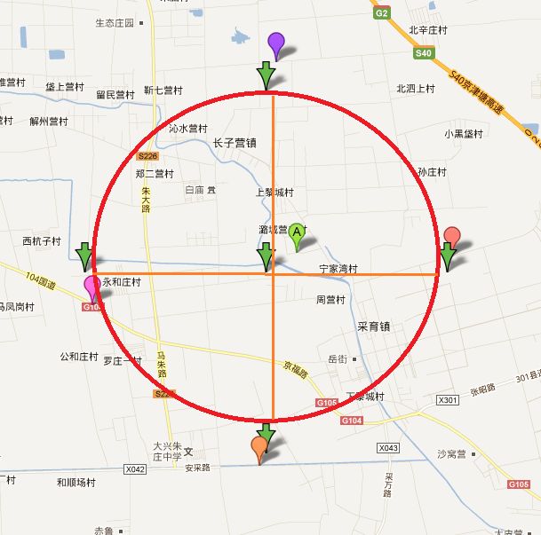
以中心生成经纬度时 正上方和正下方的精度是不变的,只有纬度变化。 生成左右时道理一样,只有精度变化,纬度是不变的。
所以只需要生成上下的纬度,左右的精度就可以了。
- /**
- * 生成以中心点为中心的四方形经纬度
- *
- * @param lat 纬度
- * @param lon 精度
- * @param raidus 半径(以米为单位)
- * @return
- */
- public static double[] getAround(double lat, double lon, int raidus) {
- Double latitude = lat;
- Double longitude = lon;
- Double degree = (24901 * 1609) / 360.0;
- double raidusMile = raidus;
- Double dpmLat = 1 / degree;
- Double radiusLat = dpmLat * raidusMile;
- Double minLat = latitude - radiusLat;
- Double maxLat = latitude + radiusLat;
- Double mpdLng = degree * Math.cos(latitude * (Math.PI / 180));
- Double dpmLng = 1 / mpdLng;
- Double radiusLng = dpmLng * raidusMile;
- Double minLng = longitude - radiusLng;
- Double maxLng = longitude + radiusLng;
- return new double[] { minLat, minLng, maxLat, maxLng };
- }
下一步是查询数据库中和四周经纬度匹配的数据。 如果数据量很大的话会很耗时间,而且会很消耗流量。所以需要用到分页查询
代码如下
- select * from mobile_user
- where mu_latitude <> 0
- and mu_longitud > #left_lat#
- and mu_longitud < #right_lat#
- and mu_latitude > #down_lon#
- and mu_latitude < #top_lon#
- and mu_u_id <> #uid#
- order by ACOS(SIN((#lat# * 3.1415) / 180 ) * SIN((mu_latitude * 3.1415) / 180 )
- +COS((#lat# * 3.1415) / 180 ) * COS((mu_latitude * 3.1415) / 180 )
- *COS((#lon# * 3.1415) / 180 - (mu_longitud * 3.1415) / 180 ) )
- * 6380 asc limit #start#,#end#
我用的是ibatis框架,sql里以#开始并结束的 是我传递过来的参数。 sql语句计算了每条数据和中心经纬度的距离并且以最近进行排序。 sql语句是根据下面的方法演变而来
方法是计算两个经纬度之间的直线距离。
- /**
- * 计算中心经纬度与目标经纬度的距离(米)
- *
- * @param centerLon
- * 中心精度
- * @param centerLan
- * 中心纬度
- * @param targetLon
- * 需要计算的精度
- * @param targetLan
- * 需要计算的纬度
- * @return 米
- */
- private static double distance(double centerLon, double centerLat, double targetLon, double targetLat) {
- double jl_jd = 102834.74258026089786013677476285;// 每经度单位米;
- double jl_wd = 111712.69150641055729984301412873;// 每纬度单位米;
- double b = Math.abs((centerLat - targetLat) * jl_jd);
- double a = Math.abs((centerLon - targetLon) * jl_wd);
- return Math.sqrt((a * a + b * b));
- }
最后就是组成json数组返回给Android使用了。