百度地图封装mixins
文章目录
-
-
- 1、思路
- 2、封装基本对象
-
- 2.1 set
-
- 2.1.1 Point
- 2.1.2 Icon
- 2.1.3 Marker
- 2.1.4 WindowInfo
- 2.1.5 Label
- 2.2 add
-
- 2.2.1 设置返回信息
- 2.2.2 Icon
- 2.2.3 PolyLine
- 2.2.4 Circle
- 2.2.5 Polygon
- 2.2.6 WindowsInfo
- 2.2.7 Label
- 3、标记清除
-
- 3.1 源码(不同地图SDK源码存在差异)
-
- 3.1.1 clearOverlays
- 3.1.2 removeOverlay
- 3.2 方法
- 4、跳转位置
- 5、修改当前地图层级
-
1、思路
/**
 * 设计想法:
 * 1、封装基本单位对象:单独封装较小单位对象(point、icon)
 * 2、返回基本对象:创建较大目标时,构造一个信息对象作为返回
 *   2.1 缓存
 *   2.2 可用于二次操作(单标记多图层...),以及更多个性化操作
 * 3、不限制于局部map对象,可用于外部map
 * 4、set* 与 add* 区别
 *   前者需要较少参数,且可自行增加额外更多操作(对象类型单一,需手动挂载图层等)
 *   后者需要较多参数,但避免较少额外操作(参数:坐标,样式对象)
 */
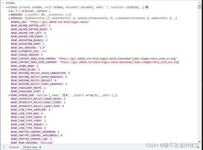
PS. 由于我是通过SDK的方式引入地图。所以地图的相关构造方法均在Window对象中。可自行打印window查看
故获取Map对象可以通过以下方式获取:
window.BMap // 不同的地图SDK可能不同名称,例如:BMap,BMAPGL
// mixins.data
data() {
    return {
        baiduMap: null, // 地图对象
        // BMAP / BMAPGL
        rootMap: "BMap", // Map对象对应key值
    }
}
2、封装基本对象
2.1 set
2.1.1 Point
/**
* 创建坐标对象
* lng 经度
* lat 纬度
*/
setPoint(lng, lat) {
   return new window[this.rootMap].Point(
       parseFloat(lng),
       parseFloat(lat)
   );
},
2.1.2 Icon
/**
* 创建图表对象
* path   图标路径
* width  图标宽度
* height 图标高度
*/
setIcon(path, width, height) {
    return new window[this.rootMap].Icon(
        path,
        new window[this.rootMap].Size(width, height),
        // anchor 图标的定位点相对于图标左上角的偏移值,设置为图标的底部中心点
        { anchor: new window[this.rootMap].Size(parseInt(width / 2), height) }
    );
},
2.1.3 Marker
/**
 * 创建标记对象
 * pointOrLng 坐标对象或经度
 * latOrIcon  纬度或图标对象
 */
setMarker(pointOrLng,latOrIcon=null) {
    // 用typeof 、instanceof 会规范
    if(latOrIcon && typeof(latOrIcon) != "object"  ) {
        return new window[this.rootMap].Marker(this.setPoint(pointOrLng,latOrIcon));
    }else if(latOrIcon) {
        return new window[this.rootMap].Marker(pointOrLng,{ icon: latOrIcon });
    }
    return new window[this.rootMap].Marker(pointOrLng);
},
2.1.4 WindowInfo
/**
 * 创建文本标注对象
 * point
 * obj 基本设置
 */
setWindowInfo(obj = null) {
    try {
        let keySet = Object.keys(obj);
        if (!keySet.length) {
            throw new Error("obj must be not null!")
        }
        let opts = {
            width: obj.width ? obj.width : 300,
            height: obj.height ? obj.height : 150,
            title: obj.title ? obj.title : "信息",
            enableMessage: true, //设置允许信息窗发送短息
            ...obj
        }
        // InfoWindow( message[窗口内容,可以为html ],style[窗口样式] )
        let info = new window[this.rootMap].InfoWindow(obj.message, opts);
        return info;
    } catch (e) {
        console.log("setWindowInfo error: ",e);
    }
},
2.1.5 Label
/**
 * 创建文本标注对象
 * message 标注信息
 * lngOrPoint 经度或坐标对象
 * lat 纬度
 */
setLabel(message,lngOrPoint,lat=null) {
    // 设置默认偏移量
	let opts = {
    	offset: new window[this.rootMap].Size(-100,23),
	}
    let point = lngOrPoint;
    if(lat && !isNaN(lngOrPoint) ) {
        point = this.setPoint(lngOrPoint,lat);
    }
	return new window[this.rootMap].Label(
        message,
        {position:point,...opts}
    );
},
2.2 add
单独封装图形(基于set方法)
2.2.1 设置返回信息
/**
 * point 坐标对象
 * mapComponent 目标的实例对象
 * type 目标类型
 * style 其他内容
 */
returnConstructor(point, mapComponent, type,style = {}) {
    return { point, mapComponent, type, ...style }
},
2.2.2 Icon
// 增加定点标记
addIcon(iconPath, lng, lat, width = 50, height = 50) {
    let point = new window[this.rootMap].Point(lng, lat)
    let icon = this.setIcon(iconPath,width,height);
    let marker = new window[this.rootMap].Marker(point, { icon })
    this.baiduMap.addOverlay(marker);
    return this.returnConstructor(point, marker,"marker");
}
2.2.3 PolyLine
// 线条
addLine(pointArr) {
    let item = [];
    if (pointArr[0] instanceof Array) {
        // pointArr 为数组
        item = pointArr.map(v => { return { lng: v[0], lat: v[1] } })
    } else {
	   // pointArr 为对象
        item = [...pointArr]
    }
    if (!new BMapGLLib.TrackAnimation) {
        console.error("the BMapGLLib.TrackAnimation is not exist!");
        return ;
    }
    let pointList = [];
    item.forEach(ele => {
        pointList.push(this.setPoint(ele.lng, ele.lat));
    })
    // 创建线条对象
    let polyLine = new window[this.rootMap].Polyline(pointList);
    // 可增加线条绘制动画 (需要查看当前地图是否带有 BMapGLLib.TrackAnimation)
    // let trackAni = new BMapGLLib.TrackAnimation(
    //    this.baiduMap,
    //    polyLine,
    //    { overallView: true, tilt: 30, duration: 10000, delay: 200, }
    // )
    // trackAni.start();
    return this.returnConstructor(pointList, polyLine,"polyLine");
}
2.2.4 Circle
// 添加圆
addCircle(lng, lat, radius = 100, style = {}) {
    let point = this.setPoint(lng, lat);
    let circle = new window[this.rootMap].Circle(
        point,
        radius,
        {
            strokeColor: "#c0c0c0", // 边线颜色
            strokeWeight: 1, // 边线宽度
            // strokeStyle: 'solid', // 边线的样式,solid或dashed
            fillColor: "blue", // 填充颜色。当参数为空时,圆形将没有填充效果。
            fillOpacity: 0.12, // 填充的透明度,取值范围0 - 1。
            // strokeOpacity: 0.8, // 边线透明度,取值范围0 - 1。
            ...style
        }
    );
    this.baiduMap.addOverlay(circle);
    return this.returnConstructor(point, circle,"circle");
},
2.2.5 Polygon
// 添加多边形
addPolygons(pointsArr, style = {}) {
    if (!pointsArr) throw new Error("pointsArr is null");
    let obj = [];
    if (pointsArr[0] instanceof Array) {
        obj = pointsArr.map(v => {
            return { lng: v[0], lat: v[1] }
        })
    } else if (pointsArr[0] instanceof Object) {
        obj = [...pointsArr];
    }
    // 参数与圆形类似,详细说明看 2.2.4
    let polyStyle = {
        strokeWeight: 1,
        strokeColor: "#c0c0c0",
        fillColor: "#ccc",
        fillOpacity: 0.12,
        ...style
    }
    let points = obj.map(item => this.setPoint(item.lng, item.lat));
    let polygon = new window[this.rootMap].Polygon(points, polyStyle);
    this.baiduMap.addOverlay(polygon);
    return this.returnConstructor(points, polygon,"polygon");
}
2.2.6 WindowsInfo
// 添加信息窗口
addWindowsInfo(obj = {}, opts={}) {
    let point = this.setPoint(obj.longitude, obj.latitude);
    let marker = this.setMarker(point);
    // 是否创建文本标注
    if(obj.showLabel) {
        marker.setLabel(this.setLabel(point,obj.site_name));
    }
    let info = this.setWindowInfo(obj);
    this.addWindowsInfoListener(marker, bMap, info, point, "click");
    this.getMap(bMap).addOverlay(marker);
    return this.returnConstructor(point, marker,"windowInfo");
},
/**
 * 创建信息窗口事件
 * tar	 绑定事件的目标对象
 * info  信息窗口对象
 * point 坐标对象
 * type  事件类型
 */
addWindowsInfoListener(tar, info, point, type = "click") {
    tar.addEventListener(type, function () {
        try {
            tar.getMap(this.baiduMap).openInfoWindow(info, point);
        } catch (e) {
            console.log("addWindowsInfoListener error: ", e.message);
        }
    })
},
2.2.7 Label
addLabel(lng, lat, message) {
    let point = this.setPoint(lng, lat);
    let label = this.setLabel(point, message);
    this.baiduMap.addOverlay(label);
    return this.returnConstructor(point, label, "label");
},
3、标记清除
官方文档中,清除标记有两种方式:
1、clearOverlays():清除地图上所有的覆盖物,可以用过触发标记对象的enableMassClear/disableMassClear方法允许/禁止被清除。
2、removeOverlay( overlay: Overlay ):从地图中移除覆盖物。如果覆盖物从未被添加到地图中,则不起任何作用添加覆盖物api:
3、addOverlay(overlay: Overlay ):
3.1 源码(不同地图SDK源码存在差异)
3.1.1 clearOverlays
clearOverlays: function() {
    this.dispatchEvent(new BaseEvent("onclearoverlays"))
},
3.1.2 removeOverlay
removeOverlay: function(t) {
    t && isFunction(t.remove) && (t.remove(),
    this.dispatchEvent(new BaseEvent("onremoveoverlay",t)))
},
3.2 方法
// 清除单个覆盖物
// 1. 调用map实例对象的removeOverlay 清除某个overlay
removeOverlay(overlay) {
    if(overlay.mapComponent) {
        this.baiduMap.removeOverlay(overlay.mapComponent);
    }else {
        this.baiduMap.removeOverlay(overlay);
    }
},
// 2. 调用overlay 的remove方法来清除自己
// overlay.mapComponent.remove()

// 清除所有覆盖物
clearOverlays() {
    this.baiduMap.clearOverlays();
},
4、跳转位置
panTo(pointsOrLng,lat=null) {
    let pointObj = {};
    if (pointsOrLng instanceof Array) {
        pointObj.lng = pointsOrLng[0];
        pointObj.lat = pointsOrLng[1];
    } else if (pointsOrLng instanceof Object) {
        pointObj = { ...pointsOrLng };
    }
    if(!isNaN(lat)) {
        this.baiduMap.panTo(this.setPoint(pointsOrLng, lat));
    }
    this.baiduMap.panTo(this.setPoint(pointObj.lng, pointObj.lat));
},
5、修改当前地图层级
// this.baiduMap.zoomTo(Index)

