GEE下载气象数据(降雨、气温、风向等)
1.数据描述
ERA5 Monthly Aggregates - Latest Climate Reanalysis Produced by ECMWF / Copernicus Climate Change ServiceERA5 is the fifth generation ECMWF atmospheric reanalysis of the global climate. Reanalysis combines model data with observations from across the world into a globally complete and consistent dataset. ERA5 replaces its predecessor, the ERA-Interim reanalysis.
数据月度汇总
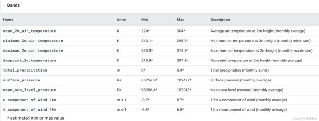
ERA5 MONTHLY provides aggregated values for each month for seven ERA5 climate reanalysis parameters: 2m air temperature, 2m dewpoint temperature, total precipitation, mean sea level pressure, surface pressure, 10m u-component of wind and 10m v-component of wind. Additionally, monthly minimum and maximum air temperature at 2m has been calculated based on the hourly 2m air temperature data. Monthly total precipitation values are given as monthly sums. All other parameters are provided as monthly averages.
ERA5 data is available from 1979 to three months from real-time. More information and more ERA5 atmospheric parameters can be found at the Copernicus Climate Data Store.
Provider’s Note: Monthly aggregates have been calculated based on the ERA5 hourly values of each parameter.
2. 确定下载的范围
本文通过经纬度坐标确定下载范围。
([97.51366, 32.63200],
[97.51366, 11.48811],
[124.3549, 11.48811],
[124.3549, 32.63200])
//研究范围
var geometry =
    ee.Geometry.Polygon(
        [[[97.51366, 32.63200],
          [97.51366, 11.48811],
          [124.3549, 11.48811],
          [124.3549, 32.63200]]], null, false);
var outsideLine = ee.Image()
                        .toByte()
                        .paint({
                              featureCollection:geometry,
                              color:0,
                              width:1
                              });
Map.centerObject(geometry, 5);
Map.addLayer(outsideLine,{color:'000000'},"outsideLine");
3.选择下载的气象波段
var dataset = ee.ImageCollection("ECMWF/ERA5/MONTHLY")
                .select('mean_2m_air_temperature')
                // .filterDate('2020-05-01', '2020-06-01');
                .filter(ee.Filter.date( '2020-05'))
                .median()
                .clip(geometry);

var visualization = {
  min: 250.0,
  max: 320.0,
  palette: [
  '000096','0064ff', '00b4ff', '33db80', '9beb4a',
  'ffeb00', 'ffb300', 'ff6400', 'eb1e00', 'af0000'
  ]
};
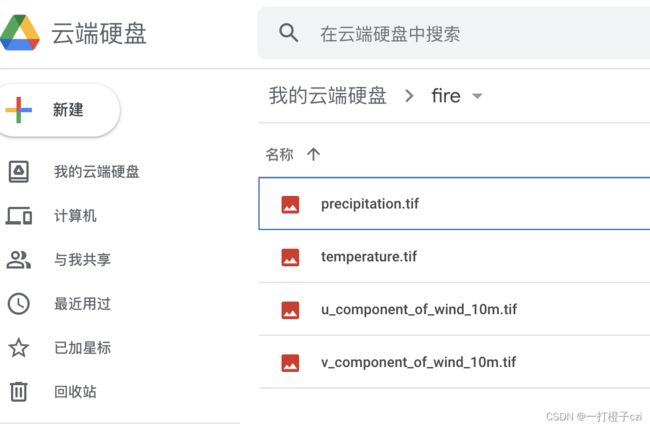
4. 导出数据
crs:指定导出数据的坐标系。4326是WGS 84 - WGS84 - World Geodetic System 1984, used in GPS。可通过http://epsg.io/?q=4326查询。
Export.image.toDrive({
  image: dataset,
  description: 'total_precipitation',
  folder:'fire',
  crs: "EPSG:4326",
  region:geometry,
  maxPixels:10e10,
});

