vargeometry=/* color: #98ff00 */ee.Geometry.Point([117.18738555908203,34.2549108395193]),table=ee.FeatureCollection("users/xyt556/XZ_City_Dissolve");
5 - Export L5T_NDVI
var landsat = ee.ImageCollection('LT5_L1T')
.filterDate('2011-01-01', '2012-01-01')
.filterBounds(geometry)
var ndvi = landsat.map(function(image) {
return image.normalizedDifference(["B4", "B3"]).rename("ndvi");
})
Map.addLayer(table)
Map.addLayer(ndvi.max(), {min:0, max:1}, "NDVI")
Map.centerObject(table, 11)
//var region = geometry.buffer(1000)
var region = table
Map.addLayer(region, {color: "yellow"}, "Region")
Export.image.toDrive({
image: ndvi.max(),
description: "NDVI",
region: region,
scale: 30,
crs: "EPSG:4326"
})
5 - Export L7T_NDVI
var landsat = ee.ImageCollection("LANDSAT/LE7_L1T_TOA")
.filterDate('2001-01-01', '2002-01-01')
.filterBounds(geometry)
var ndvi = landsat.map(function(image) {
return image.normalizedDifference(["B4", "B3"]).rename("ndvi");
})
Map.addLayer(table)
Map.addLayer(ndvi.max(), {min:0, max:1}, "NDVI")
Map.centerObject(table, 11)
//var region = geometry.buffer(1000)
var region = table
Map.addLayer(region, {color: "yellow"}, "Region")
Export.image.toDrive({
image: ndvi.max(),
description: "NDVI",
region: region,
scale: 30,
crs: "EPSG:4326"
})
5 - Export L8C_NDVI
var landsat = ee.ImageCollection("LANDSAT/LC8_L1T_TOA")
.filterDate('2013-01-01', '2014-01-01')
.filterBounds(geometry)
var ndvi = landsat.map(function(image) {
return image.normalizedDifference(["B5", "B4"]).rename("ndvi");
})
Map.addLayer(table)
Map.addLayer(ndvi.max(), {min:0, max:1}, "NDVI")
Map.centerObject(table, 11)
//var region = geometry.buffer(1000)
var region = table
Map.addLayer(region, {color: "yellow"}, "Region")
Export.image.toDrive({
image: ndvi.max(),
description: "NDVI",
region: region,
scale: 30,
crs: "EPSG:4326"
})
5 - Export L5T_NDWI
var landsat = ee.ImageCollection('LT5_L1T')
.filterDate('2011-01-01', '2012-01-01')
.filterBounds(geometry)
var ndwi = landsat.map(function(image) {
return image.normalizedDifference(["B2", "B4"]).rename("ndwi");
})
Map.addLayer(table)
Map.addLayer(ndwi.max(), {min:0, max:1}, "NDWI")
Map.centerObject(table, 11)
//var region = geometry.buffer(1000)
var region = table
Map.addLayer(region, {color: "yellow"}, "Region")
Export.image.toDrive({
image: ndwi.max(),
description: "NDWI",
region: region,
scale: 30,
crs: "EPSG:4326"
})
5 - Export L7T_NDWI
var landsat = ee.ImageCollection("LANDSAT/LE7_L1T_TOA")
.filterDate('2001-01-01', '2002-01-01')
.filterBounds(geometry)
var ndwi = landsat.map(function(image) {
return image.normalizedDifference(["B2", "B4"]).rename("ndwi");
})
Map.addLayer(table)
Map.addLayer(ndwi.max(), {min:0, max:1}, "NDWI")
Map.centerObject(table, 11)
//var region = geometry.buffer(1000)
var region = table
Map.addLayer(region, {color: "yellow"}, "Region")
Export.image.toDrive({
image: ndwi.max(),
description: "NDWI",
region: region,
scale: 30,
crs: "EPSG:4326"
})
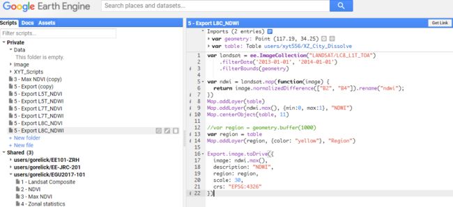
5 - Export L8C_NDWI
var landsat = ee.ImageCollection("LANDSAT/LC8_L1T_TOA")
.filterDate('2013-01-01', '2014-01-01')
.filterBounds(geometry)
var ndwi = landsat.map(function(image) {
return image.normalizedDifference(["B3", "B5"]).rename("ndwi");
})
Map.addLayer(table)
Map.addLayer(ndwi.max(), {min:0, max:1}, "NDWI")
Map.centerObject(table, 11)
//var region = geometry.buffer(1000)
var region = table
Map.addLayer(region, {color: "yellow"}, "Region")
Export.image.toDrive({
image: ndwi.max(),
description: "NDWI",
region: region,
scale: 30,
crs: "EPSG:4326"
})
