土地利用(覆盖)数据下载汇总
1.清华大学10m/30m数据下载(15,17)
网站地址http://data.ess.tsinghua.edu.cn/
最近更新了全球10m分辨率数据,下载地址http://data.ess.tsinghua.edu.cn/fromglc10_2017v01.html
p是轨道号,r是行号,基于哨兵影像,行列号排列如图
FROM-GLC 2017v1 download web URL (longitude, latitude): http://data.ess.tsinghua.edu.cn/fromglc2017v1.html( !!! See: Classification system_2017v1 )
FROM-GLC version2 (2015_v1) download web URL (longitude, latitude): http://data.ess.tsinghua.edu.cn/fromglc2015_v1.html( !!! See: Classification system_2015_v1 )
FROM-GLC 2010 download web URL (WRS-2): http://data.ess.tsinghua.edu.cn/landsat_pathList_fromglc_0_1.html
waterbody-modis-500m-2001-2016: http://data.ess.tsinghua.edu.cn/modis_500_2001_2016_waterbody.html
KML Download - FROM-GLC-seg (with download links): FROM-GLC-seg-DownloadLinks.kmz
KML Download - FROM-GLC-agg (with download links): FROM-GLC-agg-DownloadLinks.kmz
KML Download - FROM-GC (with download links): FROM-GLC-GC-DownloadLinks.kmz
KML Download - FROM-GLC-Hierarchy (with download links): FROM-GLC-Hierarchy-DownloadLinks.kmz
FROM-GLC-seg download web URL (WRS-2): http://data.ess.tsinghua.edu.cn/landsat_pathList_fromglcseg_0_1.html
FROM-GLC-agg download web URL (WRS-2): http://data.ess.tsinghua.edu.cn/landsat_pathList_fromglcagg_0_1.html
FROM-GC download web URL (WRS-2): http://data.ess.tsinghua.edu.cn/data/FROMGLCAggCropBestPick_colormap
FROM-GLC-Hierarchy download web URL (MODIS Tile): http://data.ess.tsinghua.edu.cn/data/FROMGLC_Hierarchy_MODISLIKE_GZ/
2015 US Corn/Soybean Prediction Map(MODIS Tile): http://data.ess.tsinghua.edu.cn/data/temp/2015US_CornSoybean_Map/
2016 US Corn/Soybean Prediction Map(MODIS Tile): http://data.ess.tsinghua.edu.cn/data/temp/2016US_CornSoybean_Map/
Improved Version of FROM-GLC Water Layer: http://data.ess.tsinghua.edu.cn/data/fromglc-water/
Global validation sample set (v1) : http://data.ess.tsinghua.edu.cn/data/temp/GlobalLandCoverValidationSampleSet_v1.xlsx
2010 Cropland map for China: http://data.ess.tsinghua.edu.cn/data/temp/China_LC_update_v5/
Mapping global land cover at 250 m resolution: 2001 and 2010 ([8] Wang J., et al., 2015)
![]()
需要下载,这个是根据modis数据的行列号分的,最下面还有一个分类文件,是数据分成了哪些类
据同学下载实验,和landsat数据进行了对比,发现效果还可以
自己下载几块尝试一下,分类数为
![]()
![]()
放大之后发现做的很细致
![]()
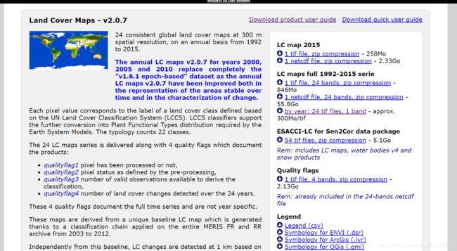
2.Landcover 欧航局300m
所选择的网站是http://maps.elie.ucl.ac.be/CCI/viewer/
可以在线查看
找右上角下载数据按钮,点击下载数据
随便填写信息,点击vailidate按钮进入下载页,就可以下载需要的数据了,还有地表反射率,水体等等数据,数据很多的
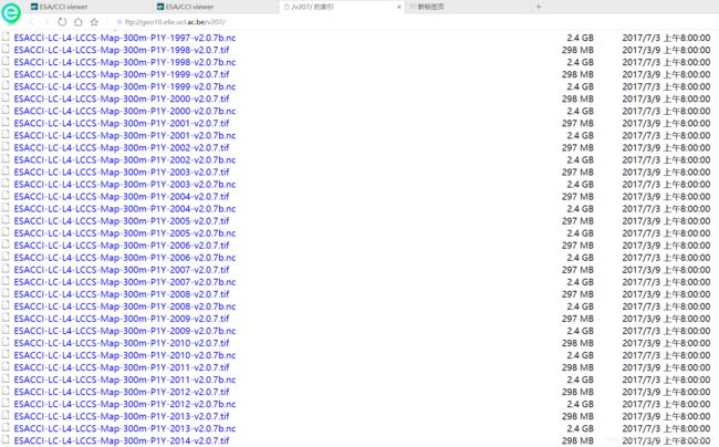
上面有24年混合在一起的24个波段的大数据,也可以选择单一年第一波段下载,92-15年中有数据的24年每年的下载地址,还提供了多种格式的数据,tif啦,nc啦。
下载2015的数据浏览一下效果,网站还良心的给你配色方案,良心的不能再良心了
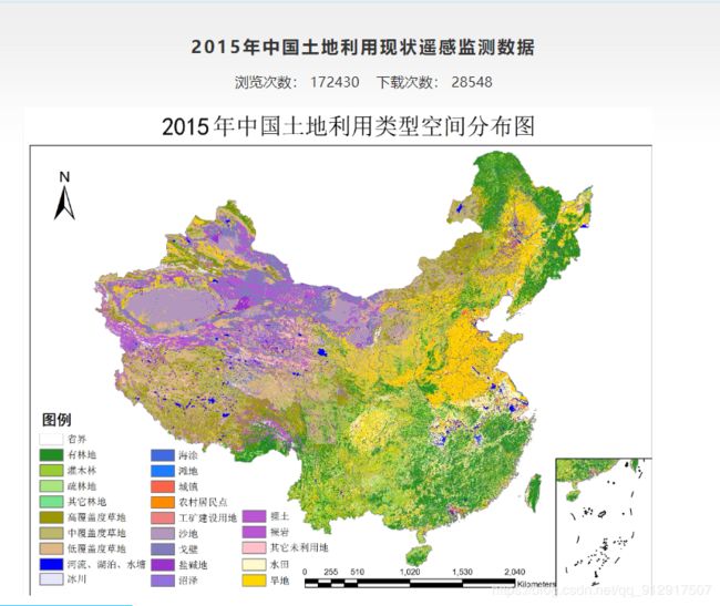
3.中科院资源环境数据中心
http://www.resdc.cn/data.aspx?DATAID=184
1980,1990,1995,2000,2005,2010,2015,2018年的数据都有
给大家免费提供下载的是1km 栅格数据,另外有100米栅格、30米栅格和矢量数据 3种类型。
4.《全球生态环境遥感监测2018年度报告》
由国家综合地球观测数据共享平台(http://www.chinageoss.org/dsp/home/index.jsp)提供,这个网站也有很多的数据
其提供的数据和清华大学30m土地覆盖数据一模一样。
5.1700,1800,1900,2000的历史土地利用数据
6.OSM土地利用数据
https://osmlanduse.org/
7.GlobeLand30 30米全球地表覆盖数据
http://mulu.tianditu.gov.cn/mapDataAction.do?method=globalLandCover
8.国家地球系统科学数据中心地球系统科学数据共享平台
http://www.geodata.cn/data/index.html?categoryId=18
9.全球变化科学研究数据出版系统
http://geodoi.ac.cn/WebCn/doi.aspx?Id=1014
基于超分辨率制图的中国大陆分省多尺度土地利用数据集(2005)
http://geodoi.ac.cn/WebCn/doi.aspx?Id=278
中国生态、居住、与工业土地利用空间数据集(2008)
http://geodoi.ac.cn/WebCn/doi.aspx?Id=454
北京市六环内5年间隔30米分辨率土地覆盖数据集


