python netcdf4读取nc格式的气象数据
一、nc格式数据介绍
NetCDF全称为network Common Data Format,中文译法为“网络通用数据格式”,netcdf文件开始的目的是用于存储气象科学中的数据,现在已经成为许多数据采集软件的生成文件的格式。从数学上来说,netcdf存储的数据就是一个多自变量的单值函数。用公式来说就是f(x,y,z,…)=value, 函数的自变量x,y,z等在netcdf中叫做维(dimension)或坐标轴(axix),函数值value在netcdf中叫做变量(Variables).而自变量和函数值在物理学上的一些性质,比如计量单位(量纲)、物理学名称等等在netcdf中就叫属性(Attributes).
二、nc格式数据读取
2.1 查看数据存储内容
import netCDF4 as nc
file = ""
dataset =nc.Dataset(file)
print(dataset.variables.keys())
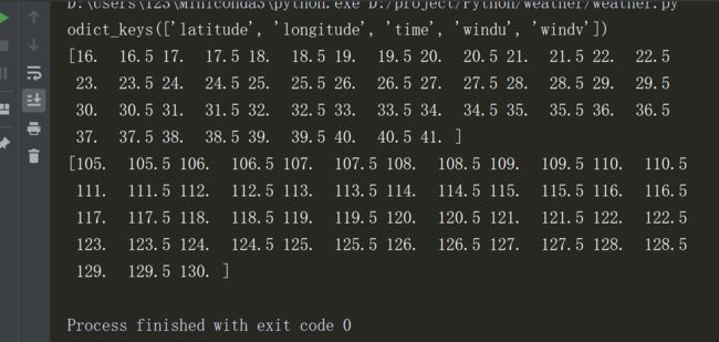
可以看到这个风场文件里属性有纬度、经度、时间、经向风、纬向风。
2.2 查看属性值
import netCDF4 as nc
file = ""
dataset =nc.Dataset(file)
print(dataset.variables.keys())
#纬度
print(dataset.variables["latitude"][:])
#经度
print(dataset.variables["longitude"][:])
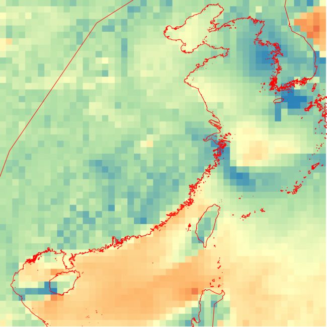
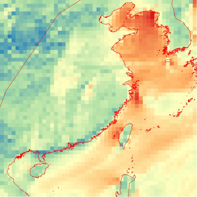
2.4 解析nc数据为tiff的完整代码
#!usr/bin/env python
# -*- coding: utf-8 -*-
"""
@Author  :
@Email   :
@Time    : 2019/12/4 16:45
@File    : weather.py
@Software: PyCharm
"""

import os
import gdal,osr
import netCDF4 as nc

def	extract_nc(nc_file):

	dataset = nc.Dataset(nc_file)
	print(dataset.variables.keys())

	lat = dataset.variables["latitude"][:]
	lon = dataset.variables["longitude"][:]

	wind_u = dataset.variables["windu"][0,:,:][::-1]
	wind_v = dataset.variables["windv"][0,:,:][::-1]

	max_lat = lat[-1]
	min_lon = lon[0]
	rows,cols =wind_u.shape

	#构造geotransform 0.5是根据latitude和longitude判断的
	geo =(min_lon,0.5,0,max_lat,0,-0.5)

	#构造projection
	src_srs = osr.SpatialReference()
	src_srs.ImportFromEPSG(4326)
	src_srs_wkt = src_srs.ExportToWkt()

	return wind_u,wind_v,geo,src_srs_wkt,rows,cols

def write_tiff(tiff_file,geo,proj,rows,cols,data_array):
	driver = gdal.GetDriverByName("Gtiff")

	outdataset = driver.Create(tiff_file,cols,rows,1,gdal.GDT_Float32)
	outdataset.SetGeoTransform(geo)
	outdataset.SetProjection(proj)

	band = outdataset.GetRasterBand(1)
	band.WriteArray(data_array)

def nc_to_tif(nc_file,output_dir):

	nc_file_name = os.path.basename(nc_file)
	output_file_name = os.path.join(output_dir,nc_file_name)

	wind_u_file = output_file_name.replace(".nc", ".windu.tif")
	wind_v_file = output_file_name.replace(".nc", ".windv.tif")

	wind_u, wind_v, geo, proj,rows,cols=extract_nc(nc_file)

	write_tiff(wind_u_file,geo,proj,rows,cols,wind_u)
	write_tiff(wind_v_file,geo,proj,rows,cols,wind_v)

if __name__ == '__main__':
	#风场数据
	wind_file = r"D:\result\wind\gfs.wind.forecast.2019112717.nc"
	#解析结果存储路径
	tiff_dir = r"D:\result"
	nc_to_tif(wind_file,tiff_dir)


