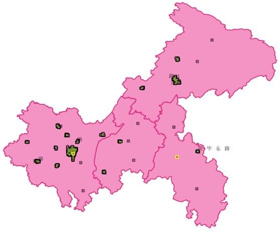
GeoServer地图开发解决方案(五):基于Silverlight技术的地图客户端实现
GeoServer 是 OpenGIS Web 服务器规范的 J2EE 实现的社区开源项目,利用 GeoServer 可以方便的发布地图数据,允许用户对特征数据进行更新、删除、插入操作,通过 GeoServer 可以比较容易的在用户之间迅速共享空间地理信息。本系列博文提供全面、完善的GeoServer部署解决方案,包括GeoServer环境搭建、地图数据处理、部署地图数据、发布地图服务等功能的详细介绍。文中内容来自本人工作中通过网络学习后总结而成,如有类同纯属巧合,同时欢迎广大网友前来交流。
系列目录导航:
GeoServer地图开发解决方案(四):发布Web地图服务(WMS)篇
GeoServer地图开发解决方案(五):基于Silverlight技术的地图客户端实现
我曾经写作过一篇关于微软Bing Maps的客户端实现的博文:《基于DeepZoom技术的Bing Maps客户端实现研究》,详细介绍了如何使用Silverlight中的DeepZoom技术实现Bing Maps的客户端。本篇介绍的内容则为基于Web地图服务(Web Map Service,简称:WMS)的Silverlight地图客户端实现。
一、DeepZoom简介
DeepZoom技术以MultiScaleImage控件为核心,其内部有一个MultiScaleTileSource类型的源属性,主要用于设置MultiScaleImage控件所要呈现的数据源。基于Silverlight的Web GIS客户端实现也是通MultiScaleImage控件来实现,核心就在于通过MultiScaleTileSource属性针对不同的Web GIS地图瓦片数据(Image Tiles)提供商为MultiScaleImage控件实现一个数据源。因此本篇所需要做的工作就是针对WMS服务为MultiScaleImage控件实现一套加载数据源的算法。
二、WMS服务加载实现
实现WMS服务加载的算法其实非常简单,只需要了解WMS发布的方式、WMS地址的参数组成结构以及地图瓦片的投影原理就可以了,首先需要定义一个盒子对象作为访问WMS的边界参数对象。
{
public int X { get ; set ; }
public int Y { get ; set ; }
public int Width { get ; set ; }
public int Height { get ; set ; }
public BBox( int x, int y, int w, int h)
{
this .X = x;
this .Y = y;
this .Width = w;
this .Height = h;
}
}
关于WMS服务加载的详细算法需要一些GIS理论基础才能够知道具体的实现原理,这里我就不逐一介绍,直接贴代码:
{
public WMSTileSource()
: base ( int .MaxValue, int .MaxValue, 0x100 , 0x100 , 0 )
{ }
public const int TILE_SIZE = 256 ;
/// <summary>
/// 地球半径
/// </summary>
public const double EARTH_RADIUS = 6378137 ;
/// <summary>
/// 地球周长
/// </summary>
public const double EARTH_CIRCUMFERENCE = EARTH_RADIUS * 2 * Math.PI;
public const double HALF_EARTH_CIRCUMFERENCE = EARTH_CIRCUMFERENCE / 2 ;
/// <summary>
/// WMS服务地址
/// </summary>
private const string TilePath = @" http://localhost:8080/geoserver/wms?service=WMS&version=1.1.0&request=GetMap&layers=cq:CQ_County_region,cq:CQ_County_region_level&styles=&bbox={0},{1},{2},{3}&width=512&height=421&srs=EPSG:4326&&Format=image/png " ;
public string GetQuadKey( string url)
{
var regex = new Regex( " .*tiles/(.+)[.].* " );
Match match = regex.Match(url);
return match.Groups[ 1 ].ToString();
}
public BBox QuadKeyToBBox( string quadKey, int x, int y, int zoomLevel)
{
char c = quadKey[ 0 ];
int tileSize = 2 << ( 18 - zoomLevel - 1 );
if (c == ' 0 ' )
{
y = y - tileSize;
}
else if (c == ' 1 ' )
{
y = y - tileSize;
x = x + tileSize;
}
else if (c == ' 3 ' )
{
x = x + tileSize;
}
if (quadKey.Length > 1 )
{
return QuadKeyToBBox(quadKey.Substring( 1 ), x, y, zoomLevel + 1 );
}
return new BBox(x, y, tileSize, tileSize);
}
public BBox QuadKeyToBBox( string quadKey)
{
const int x = 0 ;
const int y = 262144 ;
return QuadKeyToBBox(quadKey, x, y, 1 );
}
public double XToLongitudeAtZoom( int x, int zoom)
{
double arc = EARTH_CIRCUMFERENCE / (( 1 << zoom) * TILE_SIZE);
double metersX = (x * arc) - HALF_EARTH_CIRCUMFERENCE;
double result = RadToDeg(metersX / EARTH_RADIUS);
return result;
}
public double YToLatitudeAtZoom( int y, int zoom)
{
double arc = EARTH_CIRCUMFERENCE / (( 1 << zoom) * TILE_SIZE);
double metersY = HALF_EARTH_CIRCUMFERENCE - (y * arc);
double a = Math.Exp(metersY * 2 / EARTH_RADIUS);
double result = RadToDeg(Math.Asin((a - 1 ) / (a + 1 )));
return result;
}
public double RadToDeg( double d)
{
return d / Math.PI * 180.0 ;
}
private static string TileXYToQuadKey( int tileX, int tileY, int levelOfDetail)
{
var quadKey = new StringBuilder();
for ( int i = levelOfDetail; i > 0 ; i -- )
{
char digit = ' 0 ' ;
int mask = 1 << (i - 1 );
if ((tileX & mask) != 0 )
{
digit ++ ;
}
if ((tileY & mask) != 0 )
{
digit ++ ;
digit ++ ;
}
quadKey.Append(digit);
}
return quadKey.ToString();
}
protected override void GetTileLayers( int tileLevel, int tilePositionX, int tilePositionY, System.Collections.Generic.IList < object > tileImageLayerSources)
{
int zoom = tileLevel - 8 ;
if (zoom > 0 )
{
string quadKey = TileXYToQuadKey(tilePositionX, tilePositionY, zoom);
BBox boundingBox = QuadKeyToBBox(quadKey);
double lon = XToLongitudeAtZoom(boundingBox.X * TILE_SIZE, 18 );
double lat = YToLatitudeAtZoom(boundingBox.Y * TILE_SIZE, 18 );
double lon2 = XToLongitudeAtZoom((boundingBox.X + boundingBox.Width) * TILE_SIZE, 18 );
double lat2 = YToLatitudeAtZoom((boundingBox.Y - boundingBox.Height) * TILE_SIZE, 18 );
string wmsUrl = string .Format(TilePath, lon, lat, lon2, lat2, TILE_SIZE);
var veUri = new Uri(wmsUrl);
tileImageLayerSources.Add(veUri);
}
}
}
前端通过一个按钮事件驱动触发加载WMS服务,按钮的XAML代码如下:
示例我就直接基于《基于DeepZoom技术的Bing Maps客户端实现研究》一文中的示例扩展,对应的后台代码为如下代码块:
{
msi.Source = new WMSTileSource();
}

