PostGIS学习教程二十:3-D
PostGIS学习教程二十:3-D
注意:本文介绍许多PostGIS2.0及更高版本才支持的功能。
文章目录
- PostGIS学习教程二十:3-D
- 一、3-D几何图形
- 二、3-D函数
- 三、N-D索引
一、3-D几何图形
到目前为止,我们一直在处理2-D几何图形(二维几何图形),只有X和Y坐标。但是PostGIS支持所有几何图形类型额外的维度,对于每个坐标,另外还能支持用于表示高度信息的"Z"维度以及用于添加额外附加信息的"M"维度(通常为时间、道路英里或距离信息)。
对于3-D和4-D几何图形,额外的维度将作为几何图形中每个顶点的额外坐标添加,并且几何图形类型将得到增强,以指示如何解译额外的维度信息。添加额外维度信息会为每个基本几何图形额外添加三种几何图形类型:
点 —— PointZ、PointM和PointZM
线串 —— LinestringZ、LinestringM和LinestringZM
多边形 —— PolygonZ、PolygonM和PolygonZM
等等
对于well-known text(WKT)的表示,高维几何图形由ISO SQL/MM规范提供。附加维度信息仅添加到类型名称后的文本字符串中,额外坐标添加在X/Y信息之后,例如:
POINT ZM(1 2 3 4)
LINESTRING M(1 1 0, 1 2 0, 1 3 1, 2 2 0)
POLYGON Z((0 0 0, 0 1 0, 1 1 0, 1 0 0, 0 0 0))
在处理3-D和4-D几何图形时,ST_AsText()函数将返回上述表示。
对于well-known binary(WKB)表示,高维几何图形的格式由ISO SQL/MM规范提供。该格式的BNF表可在http://svn.osgeo.org/postgis/trunk/doc/bnf-wkb.txt 查询。
除了标准类型的高维形式外,PostGIS还包括一些在三维空间中有意义的新类型:
TIN(不规则三角网)允许将三角形网格建模为数据库中的行。
POLYHEDRALSURFACE(多面体表面)可以在数据库中对体积对象进行建模。
由于这两种类型都用于对三维对象建模,因此使用Z变量才是真正有意义的。POLYHEDRALSURFACE Z的一个示例是1单位立方体:
POLYHEDRALSURFACE Z (
  ((0 0 0, 0 1 0, 1 1 0, 1 0 0, 0 0 0)),
  ((0 0 0, 0 1 0, 0 1 1, 0 0 1, 0 0 0)),
  ((0 0 0, 1 0 0, 1 0 1, 0 0 1, 0 0 0)),
  ((1 1 1, 1 0 1, 0 0 1, 0 1 1, 1 1 1)),
  ((1 1 1, 1 0 1, 1 0 0, 1 1 0, 1 1 1)),
  ((1 1 1, 1 1 0, 0 1 0, 0 1 1, 1 1 1))
)
二、3-D函数
有许多函数可用于计算三维对象之间的关系:
ST_3DClosestPoint — Returns the 3-dimensional point on g1 that is closest to g2. This is the first point of the 3D shortest line.
ST_3DDistance — For geometry type Returns the 3-dimensional cartesian minimum distance (based on spatial ref) between two geometries in projected units.
ST_3DDWithin — For 3d (z) geometry type Returns true if two geometries 3d distance is within number of units.
ST_3DDFullyWithin — Returns true if all of the 3D geometries are within the specified distance of one another.
ST_3DIntersects — Returns TRUE if the Geometries “spatially intersect” in 3d - only for points and linestrings
ST_3DLongestLine — Returns the 3-dimensional longest line between two geometries
ST_3DMaxDistance — For geometry type Returns the 3-dimensional cartesian maximum distance (based on spatial ref) between two geometries in projected units.
ST_3DShortestLine — Returns the 3-dimensional shortest line between two geometries
例如,我们可以使用ST_3DDistance函数计算单位立方体与点之间的距离:
-- This is really the distance between the top corner
-- and the point.
SELECT ST_3DDistance(
  'POLYHEDRALSURFACE Z (
    ((0 0 0, 0 1 0, 1 1 0, 1 0 0, 0 0 0)),
    ((0 0 0, 0 1 0, 0 1 1, 0 0 1, 0 0 0)),
    ((0 0 0, 1 0 0, 1 0 1, 0 0 1, 0 0 0)),
    ((1 1 1, 1 0 1, 0 0 1, 0 1 1, 1 1 1)),
    ((1 1 1, 1 0 1, 1 0 0, 1 1 0, 1 1 1)),
    ((1 1 1, 1 1 0, 0 1 0, 0 1 1, 1 1 1))
  )'::geometry,
  'POINT Z (2 2 2)'::geometry
);

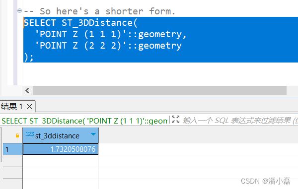
-- So here's a shorter form.
SELECT ST_3DDistance(
  'POINT Z (1 1 1)'::geometry,
  'POINT Z (2 2 2)'::geometry
);
三、N-D索引
一旦有了更高维度的数据,对其进行索引可能是有意义的。但是,在应用多维索引(multi-dimensional index)之前,应该仔细考虑数据在所有维度中的分布情况。
索引仅在使用WHERE条件查询中大幅减少返回行数时才有用。要使更高维度的索引有用,数据必须分布在该维度的广泛范围中(相对于你正在构造的查询)
一组DEM(数字高程模型)点可能并不适合构建3-D索引,因为涉及到的查询通常是提取一个2-D点框,而很少尝试选择Z维度上的信息。
如果X/Y/T空间中的一组GPS轨迹在所有维度上频繁重叠,这可能适合构建3-D索引,因为数据集在所有维度都会有很大的差异。
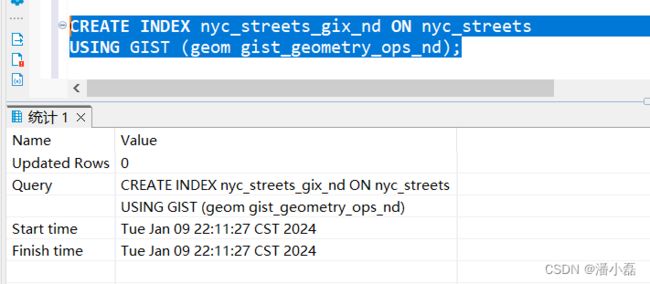
你可以为任何维度(甚至混合维度)的数据创建多维索引。例如,要在nyc_streets表上创建多维索引。
CREATE INDEX nyc_streets_gix_nd ON nyc_streets
USING GIST (geom gist_geometry_ops_nd);

gist_geometry_ops_nd参数告诉PostGIS使用N-D索引而不是标准的2-D索引。
构建索引后,可以在查询中使用&&&索引操作符,&&&和&&是相同的语义——边界框相交——区别在于,&&&使用几何图形的所有维度来应用这个语义。维数不匹配的几何图形不会相交。
-- Returns true (both 3-D on the zero plane)
SELECT 'POINT Z (1 1 0)'::geometry &&&
       'POLYGON ((0 0 0, 0 2 0, 2 2 0, 2 0 0, 0 0 0))'::geometry;

-- Returns false (one 2-D one 3-D)
SELECT 'POINT Z (1 1 1)'::geometry &&&
       'POLYGON ((0 0, 0 2, 2 2, 2 0, 0 0))'::geometry;

-- Returns true (the volume around the linestring interacts with the point)
SELECT 'LINESTRING Z(0 0 0, 1 1 1)'::geometry &&&
       'POINT(0 1 1)'::geometry;

要使用N-D索引搜索nyc_streets表,只需将&&2-D索引运算符替换为&&&3-D索引运算符。
-- N-D index operator
SELECT gid, name
FROM nyc_streets
WHERE geom &&&
      ST_SetSRID('LINESTRING(586785 4492901,587561 4493037)' :: geometry,26918);

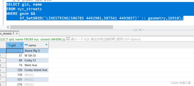
-- 2-D index operator
SELECT gid, name
FROM nyc_streets
WHERE geom &&
      ST_SetSRID('LINESTRING(586785 4492901,587561 4493037)' :: geometry,26918);

结果应该是一样的。一般来说,N-D索引只比2-D索引执行速度稍慢一些,所以只使用N-D索引,因为N-D查询将提高查询的多维度选择性。
