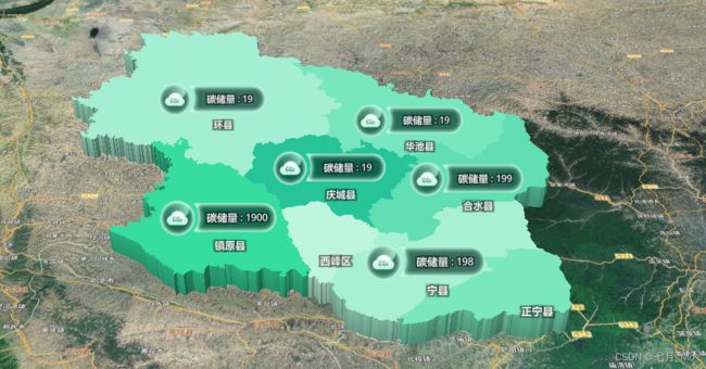
效果展示

- 主要使用了图层 的 type 属性(fill-extrusion:三维填充)
export const ADD_MAP_DIMENSIONAL_LAYER = (polygon, colorList) => {
var attrAndColor = [];
var polyline = JSON.parse(JSON.stringify(polygon));
for (var i = 0; i < polyline.features.length; i++) {
attrAndColor.push(polyline.features[i].properties.adcode);
for (let cor = 0; cor < colorList.length; cor++) {
const el = colorList[cor];
if (el.label == polyline.features[i].properties.name) {
attrAndColor.push(el.color);
}
}
polyline.features[i].geometry.type = 'MultiLineString';
polyline.features[i].geometry.coordinates = convertPolygonToPolyline(polyline.features[i].geometry.coordinates);
}
function convertPolygonToPolyline(MultiPolygon) {
var MultiLineString = [];
MultiPolygon.forEach((Polygon) => {
Polygon.forEach((LinearRing) => {
var LineString = LinearRing;
MultiLineString.push(LineString);
});
});
return MultiLineString;
}
const layers = {
id: 'qingYangPolygonSource',
type: 'fill-extrusion',
source: {
type: 'geojson',
data: polygon,
},
paint: {
'fill-extrusion-vertical-gradient': true,
'fill-extrusion-color': ['match', ['number', ['get', 'adcode']], ...attrAndColor, '#AAAAAA'],
'fill-extrusion-height': 10000,
'fill-extrusion-base': 0,
'fill-extrusion-opacity': 1,
},
};
map.addLayerToGroup(layerGroupId.MAP_DIMENSIONAL, layers);
};
const colorList = ref([
  {
    start: 1,
    end: 1,
    label: '环县',
    color: '#9de8cd',
  },
  {
    start: 2,
    end: 2,
    label: '镇原县',
    color: '#2fd59a',
  },
  {
    start: 3,
    end: 3,
    label: '西峰区',
    color: '#b6eed8',
  },
  {
    start: 4,
    end: 4,
    label: '宁县',
    color: '#a0e9cd',
  },
  {
    start: 5,
    end: 5,
    label: '正宁县',
    color: '#73e0b8',
  },
  {
    start: 6,
    end: 6,
    label: '合水县',
    color: '#5ad7ac',
  },
  {
    start: 7,
    end: 7,
    label: '庆城县',
    color: '#1ebd91',
  },
  {
    start: 8,
    end: 8,
    label: '华池县',
    color: '#71e0b8',
  },
]);
