1.前言
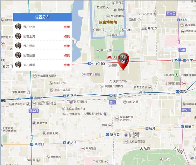
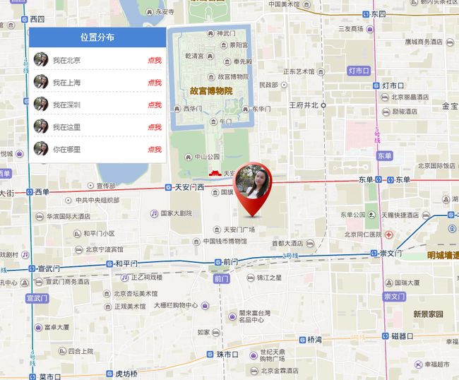
将地图嵌入到项目中的需求很多,好吧,我一般都是用的百度地图。那么今天就主要写一个完整的demo。展示一个列表,点击列表的任一内容,在地图上定位到该位置,并有动画效果。来来来,直接上demo
2.详细流程
1.引入文件
2.本demo用到两张图片 第一张是头像 sxs.jpg 第二张地图中定位图片 positionBg.png;图片你们自行替换,但是大小不一样,图片不一样,样式要自己微调哦。
3.css样式
     *{margin:0; padding:0;}
        .cleanfloat:after{display:block;clear:both;content:"";visibility:hidden;height:0;}
        #allmap{width:100%; height:800px}
        .list{position:absolute; left:50px; top:50px;background:#fff; width:240px; border:1px solid #d1d1d1; }
        .list p{width:100%; height:35px; line-height:35px; background-color:#4985d7; color:#fff; font-weight:bold; text-align:center;font-size:14px;}
        ul li{list-style:none;border-bottom:1px dashed #d1d1d1; font:500 12px/30px '微软雅黑'; margin:8px; color:#666; cursor:pointer;}
        ul li:last-child{border-bottom:none;}
        ul li img{width:26px; height:26px; border-radius:13px; float:left; margin-right:8px;}
        ul li a{float:right; color:red;}
4.html内容
  <div id="allmap">div>
    <div class="list">
        <p>位置分布p>
        <ul class="cleanfloat">ul>
    div>
5.js代码
       //初始化地图并定位到当前位置
        var map = new BMap.Map("allmap");
        var geolocation = new BMap.Geolocation();

        //游览器会弹出询问是否获取当前位置 ,点击“允许”
        geolocation.getCurrentPosition(function (r) {
            if (this.getStatus() == BMAP_STATUS_SUCCESS) {
                map.centerAndZoom(new BMap.Point(r.point.lng, r.point.lat), 15);
            }
        }, { enableHighAccuracy: true })


        $(function () {
            infoFun();
        })


        var sxs_array = [{ where: '我在北京', id:1, lng: '116.406778', lat: '39.915743', val: '我在天安门' }, { where: '我在上海',id:2, lng: '121.453503', lat: '31.159839', val: '我在上海南站' },
         { where: '我在深圳',id:3, lng: '114.004074', lat: '22.605086', val: '我在深圳野生动物园' }, {where:'我在这里',id:4},{where:'你在哪里',id:5}]


        function infoFun() {
            for (j in sxs_array) {
                if (sxs_array[j].where) {
                    $("ul").append("
 " + sxs_array[j].where + "点我

6.展示效果
3.总结
我靠,竟然花了快3个小时,从有写这个demo的想法,并开始实施,开始找图片,画页面,调试,我承认,我比较追求完美(我呸,看不出来哪里完美)至少样式也是要好好调的好吧,要不然,展现太不好看了,显得我很菜。但是我所写的每一个demo都是自己一个单词一个单词敲的,并不断的调试,虽然很简单的demo,但是我也认真对待。
如果有什么写的不好的地方,还请多指教,我必定认真改。

