Echarts实现下钻地图
问题来源
项目需要echarts进行地图响应,大致是点击区域就将该区域放大,实现交互,经过对Echarts2的例子研究,使用geoselectedchanged事件应该能达到效果。
数据
所用数据均可从Echarts下载。
guangxi.js——包含广西及下属区域的geojson
nanning.js——只有南宁边界的geojson,由于select选择返回的name属性是汉字,所以最好注册时换成一样的名称(registerMap(xx,...))。
源码
最大的特点就是利用切换图的options来实现下钻,所以要对Echarts的属性要有所了解。
var myChart = echarts.init(document.getElementById('mychart'));


	/**
	 * 获取图表属性
	 * @param name select的名称
	 */
   	function getChartOptions(name){
		return 	{
	   		geo: { //地图写在geo组件上
	            map: name, //更换的名称
	            roam: true,
	            selectedMode: 'single',
	            label: {
	                normal: {
	                    show: true,
	                    textStyle: {
	                        color: 'rgba(0,0,0,0.4)'
	                    }
	                }
	            },
	            itemStyle: {
	                normal:{
	                    borderColor: 'rgba(0, 0, 0, 0.2)'
	                },
	                emphasis:{
	                    areaColor: null,
	                    shadowOffsetX: 0,
	                    shadowOffsetY: 0,
	                    shadowBlur: 20,
	                    borderWidth: 0,
	                    shadowColor: 'rgba(0, 0, 0, 0.5)'
	                }
	            }
	        },
	   		series: [
	   			{
	   				type: 'scatter', //散点图-可以添加动态点
	                coordinateSystem: 'geo',
	                data: [{name:'测试',value:[111.277824,23.488651]}],
	                symbolSize: 20,
	                symbol: 'path://M1705.06,1318.313v-89.254l-319.9-221.799l0.073-208.063c0.521-84.662-26.629-121.796-63.961-121.491c-37.332-0.305-64.482,36.829-63.961,121.491l0.073,208.063l-319.9,221.799v89.254l330.343-157.288l12.238,241.308l-134.449,92.931l0.531,42.034l175.125-42.917l175.125,42.917l0.531-42.034l-134.449-92.931l12.238-241.308L1705.06,1318.313z',
	                symbolRotate: 35,
	                label: {
	                    normal: {
	                        formatter: '{b}',
	                        position: 'right',
	                        show: false
	                    },
	                    emphasis: {
	                        show: true
	                    }
	                },
	                itemStyle: {
	                    normal: {
	                         color: '#F06C00'
	                    }
	                }
	   			}
	   		]
	    };
	}

   	//最初的属性
   	myChart.setOption({
   		geo: {
            map: 'guangxi', //全广西
            roam: true,
            selectedMode: 'single',
            label: {
                normal: {
                    show: true,
                    textStyle: {
                        color: 'rgba(0,0,0,0.4)'
                    }
                }
            },
            regions: [{ //单例样式
        	    name: '南宁市',
        	    itemStyle: {
        	        normal: {
        	            areaColor: '#666',
        	            color: '#666'
        	        }
        	    }
           }],
            itemStyle: {
                normal:{
                    borderColor: 'rgba(0, 0, 0, 0.2)'
                },
                emphasis:{
                    areaColor: null,
                    shadowOffsetX: 0,
                    shadowOffsetY: 0,
                    shadowBlur: 20,
                    borderWidth: 0,
                    shadowColor: 'rgba(0, 0, 0, 0.5)'
                }
            }
        },
   		series: [
   			{
   				type: 'scatter',
                coordinateSystem: 'geo',
                data: [{name:'测试',value:[111.277824,23.488651]}],
                symbolSize: 20,
                symbol: 'path://M1705.06,1318.313v-89.254l-319.9-221.799l0.073-208.063c0.521-84.662-26.629-121.796-63.961-121.491c-37.332-0.305-64.482,36.829-63.961,121.491l0.073,208.063l-319.9,221.799v89.254l330.343-157.288l12.238,241.308l-134.449,92.931l0.531,42.034l175.125-42.917l175.125,42.917l0.531-42.034l-134.449-92.931l12.238-241.308L1705.06,1318.313z',
                symbolRotate: 35,
                label: {
                    normal: {
                        formatter: '{b}',
                        position: 'right',
                        show: false
                    },
                    emphasis: {
                        show: true
                    }
                },
                itemStyle: {
                    normal: {
                         color: '#F06C00'
                    }
                }
   			}
   		]
    });

	//通过该事件进行底图的变换
    myChart.on('geoselectchanged', function (params) {
        myChart.setOption(getChartOptions(params.name));
    });
效果
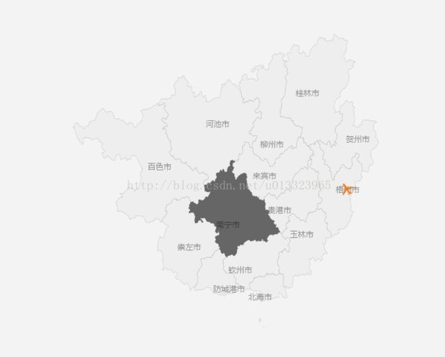
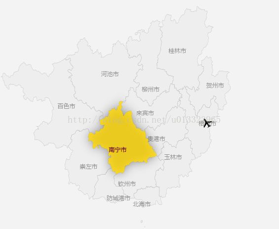
通过点击南宁市可以下钻放大到南宁区域,实现效果,而且可以添加自定义的坐标点。


