Google Earth Engine(GEE) ——统一的全球关键基础设施和指数(CISI)数据集
统一的全球关键基础设施和指数(CISI)
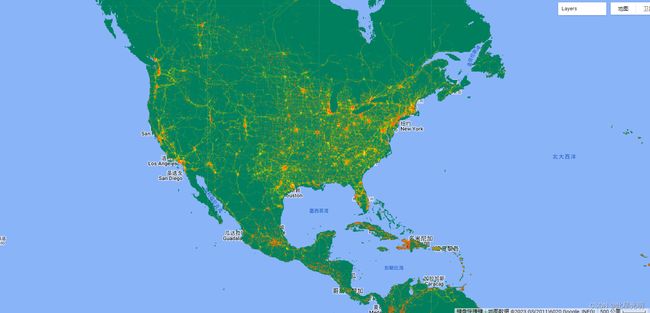
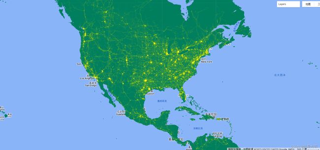
关键基础设施(CI)是社会运行的基础,是社会经济发展的骨干。然而,自然和人为的威胁给CI带来了重大风险。因此,关于CI位置的地理空间数据是深入风险分析的基础,这对于旨在减少风险的政策决策是必需的。我们提出了一个首创的全球统一的空间数据集来表示CI。
在这项研究中,用户产生了:(1)将世界主要CI系统的详细地理空间数据统一到一个地理空间数据库中;(2)一个关键基础设施空间指数(CISI)来表达CI的全球空间强度。这些数据集是使用https://planet.openstreetmap.org/,从2021年1月8日的Open Streetmap提取生成的。你可以在这里阅读该论文全文。你可以在这里下载特征类型和关键基础设施空间指数(CISI)的空间提取物。
免责声明:数据集的全部或部分描述是由作者或其作品提供的。
Paper citation
Nirandjan, S., Koks, E.E., Ward, P.J. et al. A spatially-explicit harmonized global dataset of critical infrastructure. Sci Data 9, 150 (2022).
https://doi.org/10.1038/s41597-022-01218-4
Dataset citation
Nirandjan, Sadhana, Koks, Elco E., Ward, Philip J., & Aerts, Jeroen C.J.H. (2021). A spatially-explicit harmonized global dataset of critical infrastructure (v1.0.0.)
[Data set]. Zenodo. https://doi.org/10.5281/zenodo.4957647
代码:
var global_CISI = ee.Image("projects/sat-io/open-datasets/CISI/global_CISI"),
    infrastructure = ee.ImageCollection("projects/sat-io/open-datasets/CISI/amount_infrastructure");

//导入可视化图层包
var palettes = require('users/samapriya/utils:palettes');

print(infrastructure.aggregate_array('id_no'))


//加载图层
Map.addLayer(global_CISI,{min:0,max:0.2,palette: palettes.extra.greens},'Global CISI')
Map.addLayer(infrastructure.filter(ee.Filter.eq('id_no','hospital')),{min:0,max:50,palette:palettes.extra.orngblue},'Hospitals')
License
This work is licensed under a Creative Commons Attribution 4.0 International license.
Produced by : Nirandjan, S., Koks, E.E., Ward, P.J. et al
Curated in GEE by : Samapriya Roy
Keywords: : Development indicator, global spatial data, gridded data, critical infrastructure, spatial index
Last updated on GEE: 2022-05-12


