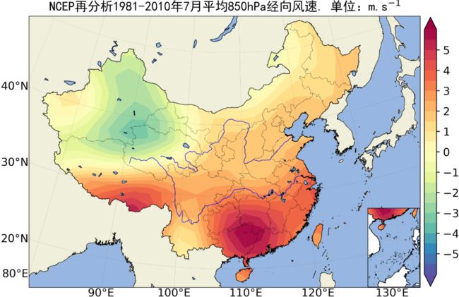
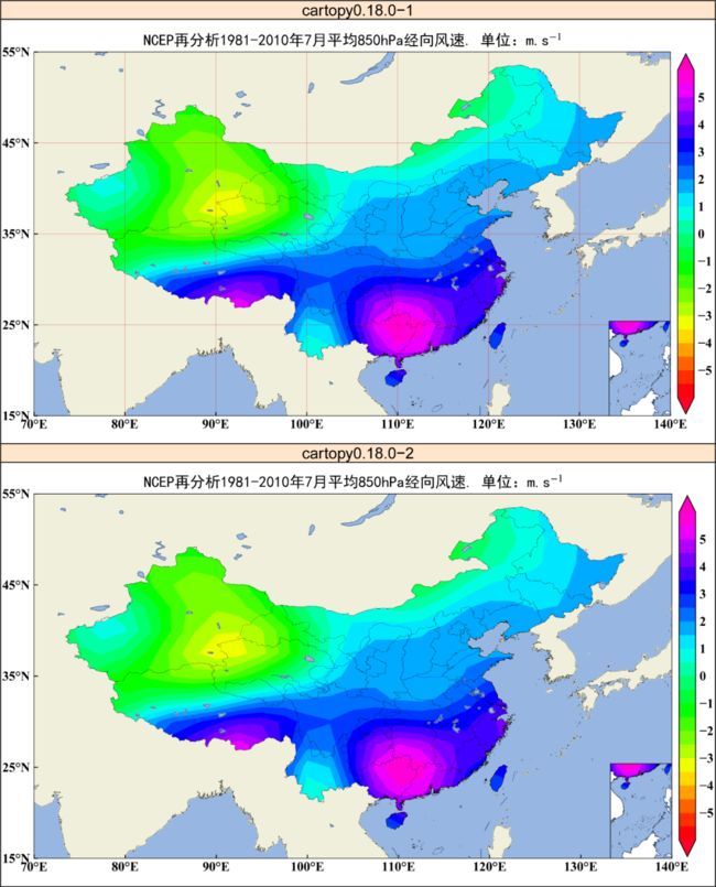
python等值线_Python兰伯特投影中国区域等值线图(含南海小地图)
兰伯特投影往期推文超链接:
《基于Python的NCEP再分析数据的中国区域白化(含南海小地图)》
注:cartopy0.18版本可解决兰勃特投影经纬度标记问题
自定义兰伯特投影:
原作者:“坎坷”大佬
PlateCarree (无坐标转换)作图:
代码调试作者:气象水文科研猫
注:因小编时间有限,代码未进行精简。
import numpy as npimport xarray as xrimport cartopy.crs as ccrsimport matplotlib.pyplot as pltimport maskout2import maskoutimport lambert_ticksfrom scipy.interpolate import Rbffrom cartopy.io.shapereader import Readerfrom cartopy.mpl.gridliner import LATITUDE_FORMATTER, LONGITUDE_FORMATTERfrom matplotlib import rcParamsconfig={"font.family":'Times New Roman',"font.size":16,"mathtext.fontset":'stix'}rcParams.update(config)plt.rcParams['figure.figsize']=(15,15)nc_data = xr.open_dataset('F:/Rpython/lp28/data/r160.nc')olon = nc_data.coords["station_lon"]olat = nc_data.coords["station_lat"]stid = nc_data.coords["station_id"]stid_data = np.random.rand(len(olon)) * 500nlon = np.linspace(70, 140, 140)nlat = np.linspace(15, 55, 60)nlon, nlat = np.meshgrid(nlon, nlat)func = Rbf(olon, olat, stid_data, function='linear')stid_pre = func(nlon, nlat)# 地图area_str = ["China"]shp_add=r'F:/RMeteoInfo/data/map/bou2_4l.shp'shp_mask=r'F:/RMeteoInfo/data/map/country1.shp'proj = ccrs.LambertConformal(central_latitude=90, central_longitude=104)fig, ax = plt.subplots(figsize=(15, 15), subplot_kw=dict(projection=proj)) # 建立页面ax.set_extent([76, 132, 16, 54.5],ccrs.PlateCarree()) # 设置经纬度范围ax.add_geometries(Reader(shp_add).geometries(),ccrs.PlateCarree(),facecolor='none',edgecolor='k',linewidth=0.7)# 等值线图con=ax.contourf(nlon,nlat,stid_pre,levels=np.arange(0,2000,200),cmap='gist_rainbow',extend='both',transform=ccrs.PlateCarree())maskout.maskout_areas(originfig=con, ax=ax, shp_path=shp_mask, area_str=area_str, proj=proj)b=plt.colorbar(con,shrink=0.6,orientation='vertical',extend='both',pad=0.035,aspect=20)# 站点分布point_locs_f = maskout.maskout_points(lon=olon, lat=olat, shp_path=shp_mask, area_str=area_str)lons_f = np.array([olon[point_loc_f] for point_loc_f in point_locs_f])lats_f = np.array([olat[point_loc_f] for point_loc_f in point_locs_f])stids_f=np.array([stid[point_loc_f] for point_loc_f in point_locs_f])ax.scatter(lons_f[::3], lats_f[::3], c='k', s=25, marker='o', transform=ccrs.PlateCarree())# 南海小地图ax_n = fig.add_axes([0.643,0.2645,0.15,0.09], projection=ccrs.PlateCarree())ax_n.set_extent([105, 123, 2, 23], ccrs.PlateCarree())ax_n.add_geometries(Reader(shp_add).geometries(),ccrs.PlateCarree(),facecolor='none',edgecolor='k',linewidth=0.7)# 等值线图con2=ax_n.contourf(nlon,nlat,stid_pre,levels=np.arange(0,2000,200),cmap='gist_rainbow',extend='both',transform=ccrs.PlateCarree())clip2=maskout2.shp2clip(con2,ax_n,r'F:/Rpython/lp3/hls/china0') #白化1# 坐标与经纬网格(兰伯特投影)fig.canvas.draw()xticks = list(range(-180, 180, 4))yticks = list(range(-90, 90, 3))ax.gridlines(xlocs=xticks, ylocs=yticks, linewidth=1.2, linestyle='--')ax.xaxis.set_major_formatter(LONGITUDE_FORMATTER)ax.yaxis.set_major_formatter(LATITUDE_FORMATTER)lambert_ticks.lambert_xticks(ax, xticks)lambert_ticks.lambert_yticks(ax, yticks)plt.tick_params(labelsize=13)font2={'family':'SimHei','size':24,'color':'k'}ax.set_title("中国降水量分布",fontdict=font2)plt.savefig('F:/Rpython/lp28/plot13.3.png',dpi=600)plt.show()本文代码和数据的百度云链接如下:
https://pan.baidu.com/s/11WFHoEaCJIyUx3Ffn_uTkA
提取码:23KJ
注:百度云链接为“坎坷”大佬提供,请读者自行调试。


