LiDAR Textbook & Automated Road Network Extraction
Original article published here, Posted on March 18, 2009 by lidar
- A positive feedback loop is beginning to develop with readers submitting information.
- There is a LIDAR textbook that I just became aware of and 2 new digital documentation conferences – one in VA and the other in Japan.
- TerraSim is working on an SBIR grant to improve the automation of extracting road networks.
As they say,”It’s nice when a plan comes together”. I am beginning to receive information from reader’s of In The Scan that they would like me to share with the 3D laser scanning community. Over time this is going to lead to better communication and more awareness of new developments. Please keep them coming.
A couple of quick items before getting into feature extraction. Professor Jie Shan from Purdue University would like me to pass on the availability of a text book, Topographic Laser Ranging and Scanning, co-authored with Charles Toth from the Center for Mapping at Ohio State. I am hoping to receive a copy so that I can do a more complete review, but this was the most popular title at the recent ASPRS meeting, and it certainly appears to cover a broad range of important topics. Thanks to both authors for making me aware of this.
A couple of conference updates. Short notice on the first. It comes from Michal Raphael at Direct Dimensions in Owings Mills, MD. Michal has only been in the laser scanning business for 14 years – a true pioneer with vision. He reports that there is a digital heritage conference, CAA 2009, next week in Williamsburg,VA.
Secondly, Doug Pritchard from the Digital Design Studio in Scotland reminded me of the Digital Documentation 2009 conference that he is organizing next month in Glasgow, and he told me of the CIPA Symposium in Kyoto, Japan October 11 – 15, 2009. I will add the new ones to the conference page.
Now, on to some cutting edge feature extraction research being conducted by Wilson Harvey on behalf of TerraSim. I briefly mentioned this last week. This work is being funded under an SBIR – Small Business Innovation Research grant involving the USACE Topographic Engineering Center – TEC. They are a leader in developing new survey engineering and mapping technology for the Army. Having worked with them in the past they are great group to get to know, and they can really help small business to incubate new technologies. If you have an applied research topic this might be a great place to promote it.
TerraSim is focused in this SBIR on improving the automation of extracting road networks from LiDAR and panchromatic/multispectral imagery. This has its obvious military value, but the goal is to also transfer the technology into the commercial GIS space. Wilson gave a detailed presentation last week at ASPRS. It was part of session number 57.
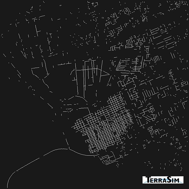
TerraSim is exploring 2 broad classes of detectable roads – one where the process exploits elevation differences using the LiDAR data and the DTM, and a second where they exploit oriented patterns and color changes. In the latter class they start by “training” the software using a known road surface, and then look for matches using the pan/intensity attributes. They are using image morphology techniques to simplify the matching. The demo that I saw on this technique was very impressive.
The following images illustrate the segments automatically obtained from the classification/filtering process, and the final results showing the automated vs. the ground truth. If you would like more details please let me know.
- See more at: http://blog.lidarnews.com/lidar-textbook-automated-road-network-extraction/#sthash.5n46fuDS.dpuf

