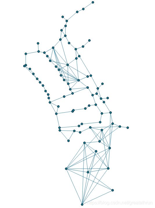
路网模型生成
源数据
点数据
通过参看文献,选择门要素、房间要素中点、不通行要素中点等作为节点在ArcGIS中创建点要素
线要素
连接不同点要素在ArcGIS中创建线要素,并删除穿越过无法通行要素的路径。
拓扑判断
在ArcGIS中通过使用拐点分割线的工具将线要素进行切割。并生成最终要使用的路径图层
构建路网数据
路网数据的构建分为两种,一种在ArcGIS中构建、一种在postGIS中构建。
ArcGIS构建网络数据集
将点要素与线要素放在同一文件夹,在线要素上右键选择创建网络数据集。
postGIS中构建网络
导入数据
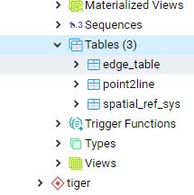
创建postGIS拓展
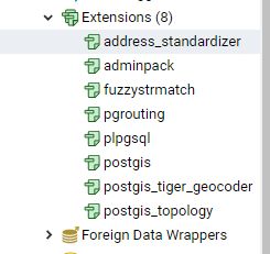
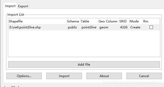
使用SHP2SQL工具,将shp导入数据库
其中
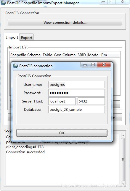
点击“View connection details…”在弹出的窗口中填入PostgreSQL的账号和密码,以及Database。
连接成功后,需要设置一下“Optionns…”
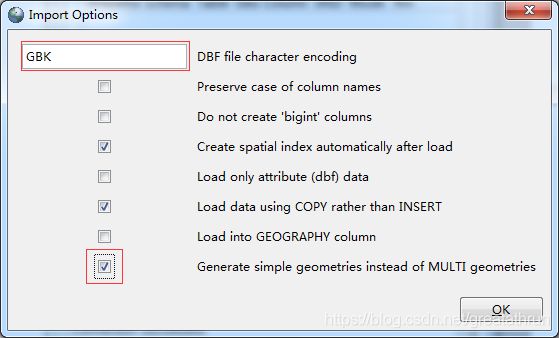
需要使用GBK编码,并勾选最下面一个选项。
添加路网数据,并设置SRID为:4326
(注意路径不能出现中文)
修改表结构
--添加起点id
ALTER TABLE public.point2line ADD COLUMN source integer;
--添加起点id
ALTER TABLE public.point2line ADD COLUMN target integer;
--添加道路权重值
ALTER TABLE public.point2line ADD COLUMN length double precision;
--添加路的起终点直角坐标坐标
alter table public.point2line add column source_x double precision;
alter table public.point2line add column source_y double precision;
alter table public.point2line add column target_x double precision;
alter table public.point2line add column target_y double precision;
创建拓扑结构
--为sampledata表创建拓扑布局,即为source和target字段赋值,其中0.000001为容忍度,大尺度小范围的图需要更低的容忍度
SELECT pgr_createTopology('public.point2line',0.0000001, 'geom', 'gid');
创建索引
--为source和target字段创建索引
CREATE INDEX source_idx ON point2line("source");
CREATE INDEX target_idx ON point2line("target");
给长度赋值
--为length赋值
update point2line set length =st_length(geom);
--为road_xblk表添加reverse_cost字段并用length的值赋值
ALTER TABLE point2line ADD COLUMN reverse_cost double precision;
UPDATE point2line SET reverse_cost =length;
给点位赋值
update public.point2line set  source_x =st_x(ST_startpoint(geom));
update public.point2line set  source_y =ST_Y(ST_STARTpoint(geom));
update public.point2line set  target_x =st_x(ST_ENDpoint(geom));
update public.point2line set  target_y =ST_Y(ST_endpoint(geom));
路径查询测试
dijkstra
-- 使用dijkstra查询最短路径,
select  b.edge as gid,
(select the_geom from point2line_vertices_pgr where id=b.node) as node_geom
, b.node ,(select geom from point2line where gid=b.edge) as geom
 from pgr_dijkstra(
	 'select gid as id, source, target, length as cost FROM point2line',2, 11,false
 ) as b;
从点2-11,并将结果中的节点与边,作为条件,对节点表和边表进行查询,获得geom并可视化。
A*
select  b.edge as gid,agg_cost,
(select the_geom from point2line_vertices_pgr where id=b.node)
as node_geom, b.node ,(select geom from point2line where gid=b.edge)
 as geom  from pgr_astar( 'select gid as id, source, target,
 	length as cost ,source_x as x1,source_y as y1,
 	target_x as x2,target_y as y2 FROM point2line',
 	80, 74,false,2 ) as b;
大概是 使用了起始点的方位作为启发函数
QGIS的查询与可视化
QGIS中layer菜单,选择对应数据库,输入密码,点击连接测试成功后
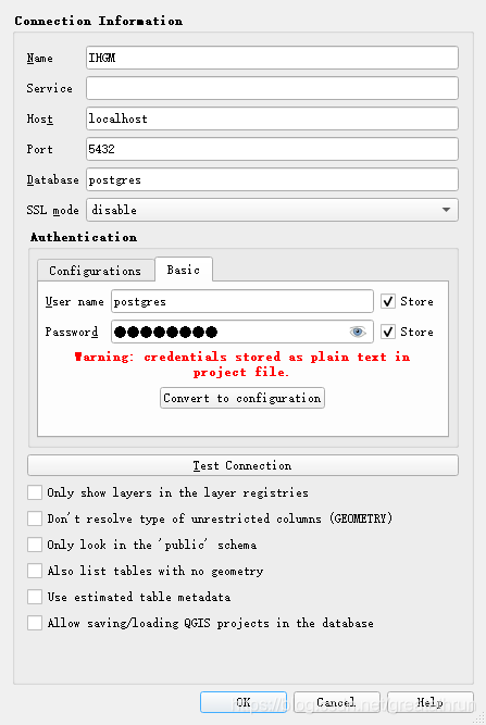
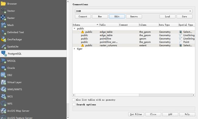
点击连接获得数据库中图层
选择要导入的图层。
获得图层后,选择数据库菜单database
选择postgis,按F2调出sql操作界面
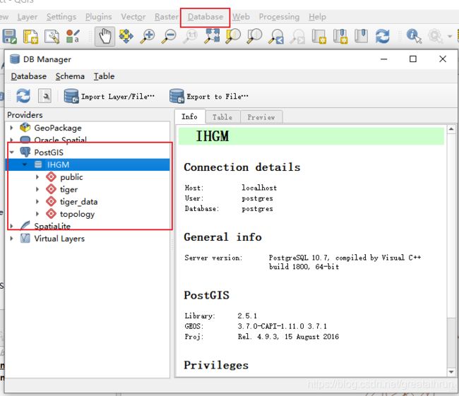
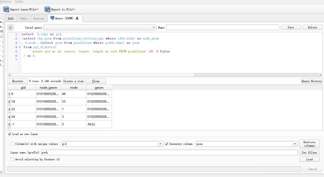
在执行框中执行查询语句。并将数据中包含的geon数据导出至QGIS界面。
导入矢量文件,六边形格网
调整样式
