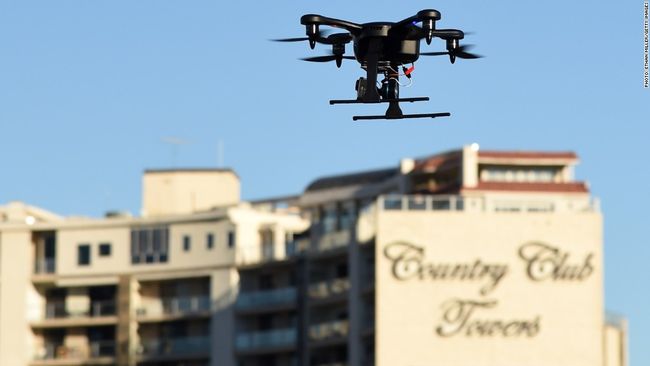
据 CNN 6月16日消息 能让美联社、路透社、纽约时报、华盛顿邮报、ABC、 NBC、Univision、 Fusion、 Conde Nast等等15家大牌媒体联手一起来做的事情是会是什么事情?新闻无人机。周二,这些新闻机构共同宣布,他们将联手共同开发、测试用于新闻收集的的无人机系统。
这项计划将与一家名为 Virginia Tech 的公司合作在弗吉尼亚进行。
On Tuesday, the coalition of 15 outlets said it has been consulting with the FAA and Virginia Teach about the research test since mid-2014, as well.
The Associated Press's vice president and director of global video, Sandy MacIntyre, said the news outlets will be harnessing "this new technology to inform the world."
"This program will allow us to use these new tools safely and effectively while also benefiting from the many new angles of visual newsgathering," MacIntyre said, calling it a "great step forward in new storytelling."
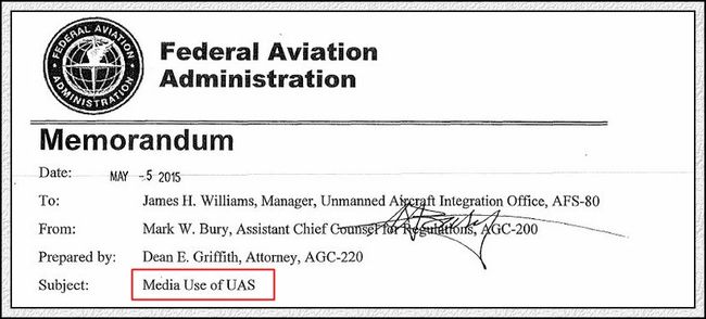
福布斯杂志网站5月7日消息,美国航空管制当局 FAA发布名为《媒体无人航空系统(UAS)的使用》备忘录,准许媒体使用非媒体机构的非职业新闻从业人员利用无人机拍摄的图像,也就是说,允许使用“公民记者”(用中国的说法是“自媒体人”)的无人机作品。但是,不允许使用职业记者、摄影记者利用无人机拍摄的作品。
这条奇怪的规定,成了人们议论的焦点。职业行为,商业目的,不行;非职业行为,个人爱好,可以。
这事实上正式开启了在美国使用无人机进行新闻报道的绿灯,虽然奇怪的规定设置了一些门槛。
报道网址,报道全文见文末
全世界都在为大地震后的尼泊尔祈福。无人机传回的新闻画面,给人们带来了新的震憾。(无人机新闻专题资料)
视频地址
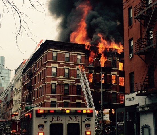
纽约昨天下午(3月26日)有一家寿司店爆炸后燃起大火。全球各地每天都有火灾,这一次也没有什么特别的,但这次火灾将成为特别的一次,因为,无人机飞抵火灾现场,拍下了一些珍贵的画面。请看这段视频:
视频地址
无人机带给我们的视频会越来越多。O2O新闻时代,或者新闻的O2O时代,将随时开启。无人机可能在未来的突发事件中,通过其镜头传回视频信号,同步在网上直播;而现场的采编人员或者现场的事件参与者们,可以通过互联网传递给他们的在线信息,进行进一步的处置或采访活动。线上、线下,各种死角正在不断被清除。人们可以以此前无法想象的视角,观照、书写历史。
当年因为核泄漏而无法靠近拍摄日本核电厂事故现场,现在,大疆无人机可以毫无后顾之忧地代劳。
有人开始用机器人写新闻,有人开始用无人机采访新闻。机器,正在史无前例地改造新闻采编手段,毫无疑问也必然因此而改造新闻业,可能还相当彻底。
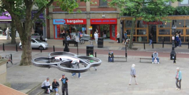
这张照片是日前出现在哈佛一个新闻学网站上的无人机街头航拍场景。哈佛尼曼实验室(新闻)日前报道,无人机新闻业务(drone journalism)的相关监管规定正在拟定中。
无人机新闻的出现,意味着什么?尼曼实验室的报道主要讨论的是监管的技术细节,对于无人机新闻可能带来的社会、文化以及商业影响,并无涉及。这项技术的前景是无限的。从大疆无人机空降白宫草坪,到大疆无人机给章子怡捎去钻戒,无人机能做的事情好象很多。如果狗仔学会了使用大疆,呵呵,悬停在汪峰家窗前的大疆,至少可以保证他上头条一次。
无人机新闻,令人期待的篇章,好象真的快要出现了。好在,那是在美国。这把双刃剑悬在头上的时候,并不总是象看汪峰争头条那样令人愉悦。
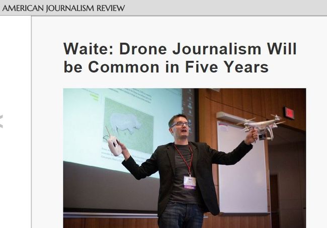
美国新闻学评论杂志说:无人机新闻五年内大家会习以为常
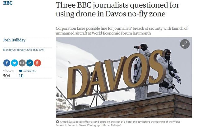
BBC超牛,在达沃斯禁飞区他们就敢玩飞机!罚款?呵呵,BBC用的全是公款,不怕罚。你看他们对自己的这个创举的报道,顽童一个。在达沃斯那地方,至于用无人机吗?中国的红旗9,可以考虑向瑞士人推销一下。
---

FAA Says Media Can Use Drone Photos From Citizen Journalists, Not Professionals
In a day of announcements from the Federal Aviation Administration on drones yesterday, the one that struck me as the most significant was the one released without any fanfare, a legal memo from the FAA’s Chief Counsel’s Office titledMedia Use of UAS.UAS, or unmanned aerial systems, is the FAA’s preferred term for drones. The memo lays out the FAA’s legal analysis of why citizen journalists using drones to photograph newsworthy events could legally sell those photos to the media where professional news photographers could not. The FAA’s analysis depends on the hobby or recreational use of drones vs. non-hobby or commercial use distinction that it has created. According to the FAA’s memo, the news media cannot use drones to gather news images nor can professional photographers in the business of taking and selling photos use drones without FAA permission. However, hobby photographers using drones could: “If the individual’s [sic] takes the pictures or videos or gathers other information as part of a hobby or recreational activity, then a later decision to sell some or all of those pictures, videos or other information” would not change the character of the operation and “no FAA authorization for that operation would be required.”
According to the FAA’s memo, “a person who wishes to operate a UAS to take pictures or videos or gather other information that would be sold to media outlets would need an FAA authorization for the operation” just like any other non-hobby use. The problem for professional photographers and media organizations that want to use drones is that even if they obtain FAA approval via a so-called 333 exemption, the restrictions placed on UAS operations by the terms of the exemption would make drone use impossible in all but the most remote areas. The most problematic restriction contained in all the 333 exemptions I’ve seen to date require the drone to remain at least 500 feet from non-participating “persons, vessels, vehicles or structures” unless the operator receives permission from each person and each owner of any vehicle, vessel and structure. Alternatively, the drone operator would have to ensure that sufficient barriers are built to protect people in the event the drone crashes. According to the restrictions, if a person moves away from the barrier, the drone operation must immediately cease. Clearly these restrictions would preclude use of a drone for newsgathering by media companies and professional photographers.
So the end result of the FAA’s legal memo is that we now have a situation in the United States where citizen journalists may be the only ones able to gather drone images of disaster scenes or other scenes perhaps too difficult to reach by land and too dangerous for manned aircraft. As Jason Koebler points out inMotherboard, surely this has implications for a free press and the First Amendment.
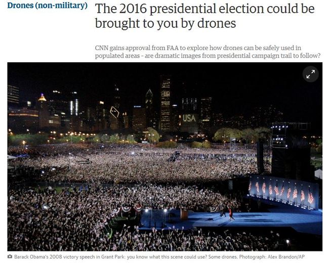
As far as the other two FAA announcements – made at the Association for Unmanned Vehicle Systems’ conference in Atlanta, these were much less significant in my mind, yet merited an FAA media advisory the day before. The first announcement at the UAS conference was an FAA-industry partnership to expand research into uses of unmanned aircraft – one with CNN to explore using visual line-of-sight use of drones for newsgathering in urban areas and two others, with Precisionhawk and BNSF Railroad, to explore uses of drones beyond line-of-sight. Beyond line of sight flights are taking place now and have been for years so the FAA’s announcement was met with a fair amount of derision on various drone web sites.
The second announcement by the FAA was of a new smartphone app, B4UFly, which will be unveiled sometime this summer to 1,000 beta testers. The app will be limited to iOS devices initially, although an Android version is expected to follow. The app is intended to help drone pilots determine whether there are any restrictions in place in the area where they intend to fly. According to reports from the conference, the FAA’s Administrator stated that the app development cost in the “seven figures.”
Well, a smartphone app is a great idea, but many of us have already been beta testing one developed by my Forbes colleague, Gregory McNeal, and Ben Marcus. TheAirMap.ioapp they developed is simple to use on iOS and Android devices and gives users an easy way to determine if the airspace they want to fly in is restricted or not. It even incorporates private property owners who have registered with NoFlyZone.org so drone operators know which properties to avoid for hassle-free flying. And, best of all, the app is free. And no tax payer money was used in its development.
